IMAGES TAKEN NEAR TO
Bracken Way, HIGH WYCOMBE, HP10 9JX
Introduction
This page details the photographs taken nearby to Bracken Way, HP10 9JX by members of the Geograph project.
The Geograph project started in 2005 with the aim of publishing, organising and preserving representative images for every square kilometre of Great Britain, Ireland and the Isle of Man.

There are currently over 7.5m images from over14,400 individuals and you can help contribute to the project by visiting https://www.geograph.org.uk
Image Map
Images are licensed for reuse under creativecommons.org/licenses/by-sa/2.0
Notes
- Clicking on the map will re-center to the selected point.
- The higher the marker number, the further away the image location is from the centre of the postcode.
Image Listing (9 Images Found)
Images are licensed for reuse under creativecommons.org/licenses/by-sa/2.0
Image
Details
Distance
1
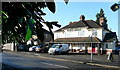
Green Dragon, Flackwell Heath
Apparently not the sort of pub that you would take your mother to.
Image: © Graham Horn
Taken: 5 Dec 2010
0.10 miles
2
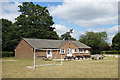
Pavilion, Green Dragon Lane
Green Dragon Lane Recreation Ground. The Green Dragon is a pub a short way down the road.
Image: © Des Blenkinsopp
Taken: 15 Jul 2019
0.15 miles
3
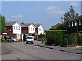
Cherry Rise, Flackwell Heath
A short residential cul de sac off The Orchard.
Image: © Des Blenkinsopp
Taken: 15 Jul 2019
0.16 miles
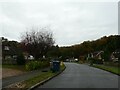
4
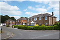
Churchill Close, Flackwell Heath
Flackwell Heath is a large village of mostly post-war houses. It is part of Chepping Wycombe Parish which also includes Loudwater and Tyler's Green.
Image: © Andrew Smith
Taken: 8 Aug 2009
0.16 miles
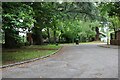
5
Navigating northwards up the Bashire (54)
Mid section of Willow Close
Image: © Basher Eyre
Taken: 29 Oct 2024
0.17 miles
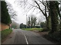
7
Houses at Flackwell Heath
These are at the southern end of the village, with the woodland of Ronald Wood behind them and open countryside within 100 yards.
Image: © Graham Horn
Taken: 5 Dec 2010
0.22 miles
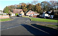
9
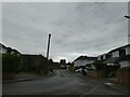
Navigating northwards up the Bashire (55)
Junction of Strathcona Way and Strathcona Close
Image: © Basher Eyre
Taken: 29 Oct 2024
0.23 miles