IMAGES TAKEN NEAR TO
Bank Road, HIGH WYCOMBE, HP10 8LA
Introduction
This page details the photographs taken nearby to Bank Road, HP10 8LA by members of the Geograph project.
The Geograph project started in 2005 with the aim of publishing, organising and preserving representative images for every square kilometre of Great Britain, Ireland and the Isle of Man.

There are currently over 7.5m images from over14,400 individuals and you can help contribute to the project by visiting https://www.geograph.org.uk
Image Map
Images are licensed for reuse under creativecommons.org/licenses/by-sa/2.0
Notes
- Clicking on the map will re-center to the selected point.
- The higher the marker number, the further away the image location is from the centre of the postcode.
Image Listing (161 Images Found)
Images are licensed for reuse under creativecommons.org/licenses/by-sa/2.0
Image
Details
Distance
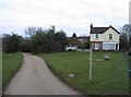
5
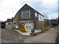
Home improvements - Bank Road
Tylers Green.
Image: © Mr Ignavy
Taken: 22 Feb 2009
0.02 miles
6
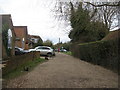
Gravel side lane
Known as Bank Road, Tylers Green.
Image: © Mr Ignavy
Taken: 22 Feb 2009
0.03 miles
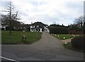
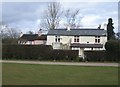
8
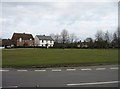
Houses over looking The Common
Tylers Green.
Image: © Mr Ignavy
Taken: 22 Feb 2009
0.03 miles
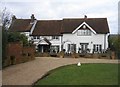
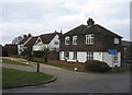
10
A village house
Bank Road, Tylers Green.
Image: © Mr Ignavy
Taken: 22 Feb 2009
0.04 miles