IMAGES TAKEN NEAR TO
Flaxby, KNARESBOROUGH, HG5 0RU
Introduction
This page details the photographs taken nearby to HG5 0RU by members of the Geograph project.
The Geograph project started in 2005 with the aim of publishing, organising and preserving representative images for every square kilometre of Great Britain, Ireland and the Isle of Man.

There are currently over 7.5m images from over14,400 individuals and you can help contribute to the project by visiting https://www.geograph.org.uk
Image Map
Images are licensed for reuse under creativecommons.org/licenses/by-sa/2.0
Notes
- Clicking on the map will re-center to the selected point.
- The higher the marker number, the further away the image location is from the centre of the postcode.
Image Listing (11 Images Found)
Images are licensed for reuse under creativecommons.org/licenses/by-sa/2.0
Image
Details
Distance
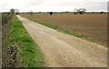
1
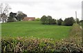
Spring Bank Farm
A view from the stretch of Shortsill Lane shown in Image The Knaresborough Round crosses the image passing the line of trees centre right.
Image: © Derek Harper
Taken: 3 Apr 2012
0.05 miles
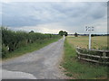
2
Drive to Spring Bank Farm Coneythorpe from Shortsill Lane
Image: © Peter Robinson
Taken: 15 Oct 2011
0.15 miles
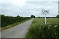
3
Shortsill Lane towards Flaxby
Shortsill Lane from the entrance to Castle Farm.
Image: © DS Pugh
Taken: 4 Jun 2023
0.17 miles
4
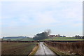
Approaching Shortsill Lane
Following the access track from Castle Farm to reach Shortsill Lane between the small communities of Flaxby and Coneythorpe.
Spring Bank Farm can be seen on the low hill in the distance.
Image: © Chris Heaton
Taken: 31 Dec 2014
0.18 miles
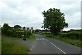
5
Shortsill Lane near Castle Farm
Looking towards Coneythorpe from the entrance to Castle Farm.
Image: © DS Pugh
Taken: 4 Jun 2023
0.18 miles
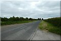
6
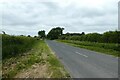
Shortsill Lane
The road between Flaxby and Coneythorpe runs straight for 600 metres here, with wide verges.
Image: © Derek Harper
Taken: 3 Apr 2012
0.18 miles
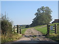
7
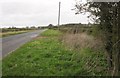
Entrance to Castle Farm
The drive is a bridleway leading via Castle Farm to Hay a Park and Knaresborough.
Image: © DS Pugh
Taken: 4 Jun 2023
0.19 miles
8
Hay-a-Park Lane
On the other side of Shortsill Lane from Image Bridleway 15 25/1/1 follows this track across Low Shortsill and Brown Moor.
Image: © Derek Harper
Taken: 3 Apr 2012
0.20 miles
9
The Old School House
Approaching the village of Flaxby along Shortsill Lane.
Image: © DS Pugh
Taken: 4 Jun 2023
0.24 miles