
IMAGES TAKEN NEAR TO
Nunwick, RIPON, HG4 5ED
Introduction
This page details the photographs taken nearby to HG4 5ED by members of the Geograph project.
The Geograph project started in 2005 with the aim of publishing, organising and preserving representative images for every square kilometre of Great Britain, Ireland and the Isle of Man.

There are currently over 7.5m images from over14,400 individuals and you can help contribute to the project by visiting https://www.geograph.org.uk
Image Map
Images are licensed for reuse under creativecommons.org/licenses/by-sa/2.0
Notes
- Clicking on the map will re-center to the selected point.
- The higher the marker number, the further away the image location is from the centre of the postcode.
Image Listing (17 Images Found)
Images are licensed for reuse under creativecommons.org/licenses/by-sa/2.0
Image
Details
Distance
1
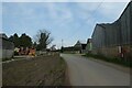
Passing Nunwick Farm
Looking at various farm buildings in Nunwick.
Image: © DS Pugh
Taken: 31 Mar 2021
0.02 miles
3

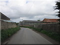
Farm buildings at Nunwick Grange
The buildings around Nunwick House form a large proportion of the whole village.
Image: © Bill Boaden
Taken: 17 May 2013
0.05 miles
4
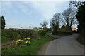
Sign for Nunwick
Entering the village of Nunwick, with the sign in need of repairs.
Image: © DS Pugh
Taken: 31 Mar 2021
0.10 miles
5
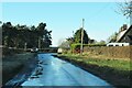
Road through Nunwick
Nunwick is more hamlet than village, with a couple of farms and a scattering of houses.
Image: © Gordon Hatton
Taken: 31 Dec 2020
0.11 miles
6

Nunwick Beck
Small beck that flows close alongside the road for some way before discharging into the Ure.
Image: © Gordon Hatton
Taken: 31 Dec 2020
0.13 miles
7
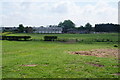
Farmland below Hall Garth Hill
Looking in the direction of Nunwick.
Image: © Bill Boaden
Taken: 17 May 2013
0.14 miles
8

Nunwick Beck
It is between Cat & Fiddle Bridge and King's Bridge, entering the Ure valley basin.
Image: © Bill Boaden
Taken: 17 May 2013
0.15 miles
9
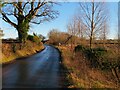
Road to Hutton Conyers
The road from Nunwick to Hutton Conyers and Ripon
Image: © Gordon Hatton
Taken: 31 Dec 2020
0.16 miles
10
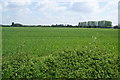
Site of a henge
The site is marked on the map, but there is really nothing that can be discerned from the road.
Image: © Bill Boaden
Taken: 17 May 2013
0.17 miles