
IMAGES TAKEN NEAR TO
Main Street, RIPON, HG4 3SD
Introduction
This page details the photographs taken nearby to Main Street, HG4 3SD by members of the Geograph project.
The Geograph project started in 2005 with the aim of publishing, organising and preserving representative images for every square kilometre of Great Britain, Ireland and the Isle of Man.

There are currently over 7.5m images from over14,400 individuals and you can help contribute to the project by visiting https://www.geograph.org.uk
Image Map
Images are licensed for reuse under creativecommons.org/licenses/by-sa/2.0
Notes
- Clicking on the map will re-center to the selected point.
- The higher the marker number, the further away the image location is from the centre of the postcode.
Image Listing (24 Images Found)
Images are licensed for reuse under creativecommons.org/licenses/by-sa/2.0
Image
Details
Distance
1
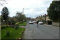
Main Street, Kirkby Malzeard
Looking along Main Street through the village.
Image: © DS Pugh
Taken: 15 Apr 2022
0.02 miles
2
![Main Street [west end] at Kirkby Malzeard](https://s1.geograph.org.uk/photos/76/39/763989_220c6e3b_120x120.jpg)
Main Street [west end] at Kirkby Malzeard
The linear village of Kirkby Malzeard extends westwards into this square, but there is nothing of note apart from houses of different periods. These stone built cottages line the north side of the street.
Image: © Gordon Hatton
Taken: 14 Apr 2008
0.05 miles
3
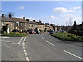
Kirkby Malzeard
View of road through village, looking east
Image: © Angela Tuff
Taken: 13 Apr 2006
0.06 miles
4
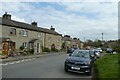
Main Street from the western end
Looking along Main Street in Kirkby Malzeard from the western edge of the village.
Image: © DS Pugh
Taken: 15 Apr 2022
0.09 miles
5
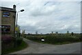
Back Lane
Looking onto Back Lane in Kirkby Malzeard.
Image: © DS Pugh
Taken: 15 Apr 2022
0.12 miles
6
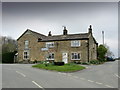
Road Junction, Kirkby Malzeard
Road junction at the western end of Kirkby Malzeard village.
Image: © Chris Heaton
Taken: 25 Apr 2012
0.13 miles
7
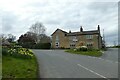
Western end of the village
Ringbeck Road is to the right.
Image: © DS Pugh
Taken: 15 Apr 2022
0.13 miles
8
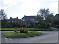
Road junction in Kirkby Malzeard
Looking eastward.
Image: © Peter Wood
Taken: 2 Sep 2014
0.13 miles
9
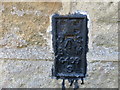
Ordnance Survey Flush Bracket S0409
This can be found on the roadside wall of a house in Kirkby Malzeard.
For more detail see : http://www.bench-marks.org.uk/bm11417
Image: © Peter Wood
Taken: 2 Sep 2014
0.13 miles
10
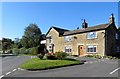
Road junction in Kirkby Malzeard
At the west end of the village.
Image: © philandju
Taken: 2 Oct 2015
0.14 miles