
IMAGES TAKEN NEAR TO
Dallowgill, RIPON, HG4 3RF
Introduction
This page details the photographs taken nearby to Dallowgill, HG4 3RF by members of the Geograph project.
The Geograph project started in 2005 with the aim of publishing, organising and preserving representative images for every square kilometre of Great Britain, Ireland and the Isle of Man.

There are currently over 7.5m images from over14,400 individuals and you can help contribute to the project by visiting https://www.geograph.org.uk
Image Map
Images are licensed for reuse under creativecommons.org/licenses/by-sa/2.0
Notes
- Clicking on the map will re-center to the selected point.
- The higher the marker number, the further away the image location is from the centre of the postcode.
Image Listing (15 Images Found)
Images are licensed for reuse under creativecommons.org/licenses/by-sa/2.0
Image
Details
Distance
1
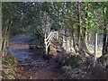
Footbridge over the River Laver
Belford Lane, happily a green lane fords the River Laver at this point. The addition of a footbridge makes life easier for pedestrians.
Image: © Chris Heaton
Taken: 6 Dec 2005
0.03 miles
2
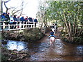
Fording the Laver
A trio of horse riders negotiate the ford, watched by a group of walkers from the bridge.
Image: © Gordon Hatton
Taken: 27 Jan 2008
0.07 miles
3
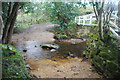
Ford at Belford
This ford on the River Laver is found on Belford Lane, a byway leading to Hedge Nook.
Image: © John Walton
Taken: 12 Apr 2015
0.07 miles
5
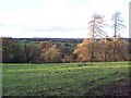
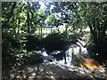
Field above Laver Valley
Photograph taken from Belford Lane, a wide track coming out of the Laver Valley
Image: © Chris Heaton
Taken: 6 Dec 2005
0.10 miles
7
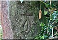
Kirkby Malzeard, Belford Lane
The benchmark is cut into a gatepost on the east side of Belford Lane.
Image: © Mel Towler
Taken: 9 Nov 2021
0.15 miles
8
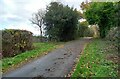
Kirkby Malzeard, Belford Lane
There is a benchmark cut into the right hand gatepost on the east side of Belford Lane.
Image: © Mel Towler
Taken: 9 Nov 2021
0.15 miles
9
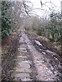
Unmade Lane near Laverton
This may also be part of Belford Lane which continues to the south. One of several unmade lanes to the west of Laverton, and may well be a medieval routeway. The modern roads tend to follow straight lines along the hilltops, these mostly being enclosure roads. Note the stone slabs, which unfortunately come to an end just as the really muddy section begins.
Image: © Gordon Hatton
Taken: 16 Dec 2007
0.16 miles
10
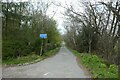
Belford Lane
With a sign indicating unsuitable for motor vehicles.
Image: © DS Pugh
Taken: 15 Apr 2022
0.19 miles