IMAGES TAKEN NEAR TO
Palace Road, RIPON, HG4 3HN
Introduction
This page details the photographs taken nearby to Palace Road, HG4 3HN by members of the Geograph project.
The Geograph project started in 2005 with the aim of publishing, organising and preserving representative images for every square kilometre of Great Britain, Ireland and the Isle of Man.

There are currently over 7.5m images from over14,400 individuals and you can help contribute to the project by visiting https://www.geograph.org.uk
Image Map (Loading...)


Getting Data...Please wait
Leaflet Map data © OpenStreetMap
Images are licensed for reuse under creativecommons.org/licenses/by-sa/2.0
Notes
- Clicking on the map will re-center to the selected point.
- The higher the marker number, the further away the image location is from the centre of the postcode.
Image Listing (6 Images Found)
Images are licensed for reuse under creativecommons.org/licenses/by-sa/2.0
Image
Details
Distance
1
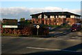
Entrance to Spring Hill School
Spring Hill School is run by Barnardo's and caters for pupils aged 9 - 19 with special needs.
Image: © Jonathan Thacker
Taken: 23 Jun 2014
0.10 miles
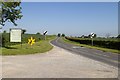
3
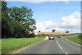
A6108 near Stanton Mortimer School
Approaching derestriction signs
Image: © John Firth
Taken: 30 Jul 2012
0.18 miles