
IMAGES TAKEN NEAR TO
Doublegates Walk, RIPON, HG4 2TX
Introduction
This page details the photographs taken nearby to Doublegates Walk, HG4 2TX by members of the Geograph project.
The Geograph project started in 2005 with the aim of publishing, organising and preserving representative images for every square kilometre of Great Britain, Ireland and the Isle of Man.

There are currently over 7.5m images from over14,400 individuals and you can help contribute to the project by visiting https://www.geograph.org.uk
Image Map
Images are licensed for reuse under creativecommons.org/licenses/by-sa/2.0
Notes
- Clicking on the map will re-center to the selected point.
- The higher the marker number, the further away the image location is from the centre of the postcode.
Image Listing (9 Images Found)
Images are licensed for reuse under creativecommons.org/licenses/by-sa/2.0
Image
Details
Distance
1
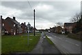
Along Clotherholme Road
Looking along the road towards the city.
Image: © DS Pugh
Taken: 4 Feb 2018
0.17 miles
2
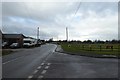
Junction on Clotherholme Road
Looking away from Ripon along Clotherholme Road.
Image: © DS Pugh
Taken: 4 Feb 2018
0.19 miles
3
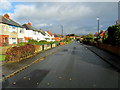
Bishopton Lane
Residential road on the western fringes of Ripon, North Yorkshire
Image: © Chris Heaton
Taken: 16 Oct 2012
0.21 miles
4
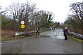
Bridge over the River Laver
The runners are taking part in the Muddy Boots 10k.
Image: © DS Pugh
Taken: 4 Feb 2018
0.23 miles
5
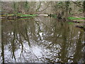
Laver Weirpool
The widening of the River Laver here caused by Bishopton Weir to create a head of water for the now disused mill race to Bishopton Mill.
Image: © Matthew Hatton
Taken: 27 Mar 2011
0.23 miles
6
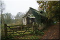
Roofless shed near the allotments
There are several allotments over to the left. The shed appears quite old but has had some partial renovation which doesn't yet extend to a roof. The track used to go to Bishopton Mill.
Image: © Bill Boaden
Taken: 11 Nov 2011
0.23 miles
7
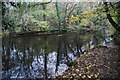
The River Laver above Bishopton Weir
A good footpath ends at this point. I was hoping it would allow me to cross the river but I presume it originally just went to the mill which no longer exists.
Image: © Bill Boaden
Taken: 11 Nov 2011
0.25 miles
8
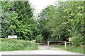
No Entry!
Track off Galphay Lane to the west of Ripon leading into MOD land. The barracks on the west side of the city are now largely redundant, so it is unlikely that one would be shot if entering this area. [don't try it though]
Image: © Gordon Hatton
Taken: 20 Aug 2018
0.25 miles
9
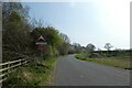
Sign warning of military traffic
Looking along the road between Galphay and Ripon as it runs beside Ripon Barracks.
Image: © DS Pugh
Taken: 16 Apr 2022
0.25 miles