IMAGES TAKEN NEAR TO
High Cleugh, RIPON, HG4 2QA

Introduction

This page details the photographs taken nearby to High Cleugh, HG4 2QA by members of the Geograph project.

The Geograph project started in 2005 with the aim of publishing, organising and preserving representative images for every square kilometre of Great Britain, Ireland and the Isle of Man.

There are currently over 7.5m images from over14,400 individuals and you can help contribute to the project by visiting https://www.geograph.org.uk

Image Map


Images are licensed for reuse under creativecommons.org/licenses/by-sa/2.0
Notes
  • Clicking on the map will re-center to the selected point.
  • The higher the marker number, the further away the image location is from the centre of the postcode.

Image Listing (54 Images Found)

Images are licensed for reuse under creativecommons.org/licenses/by-sa/2.0
  • ...
Image
Details
Distance
1
High Cleugh
Looking across a park towards the River Skell.
Image: © DS Pugh Taken: 27 Dec 2015
0.01 miles
2
Small Park beside the River Skell
Small stretch of green park sandwiched between Mallorie Park Drive and the River Skell in Ripon
Image: © Chris Heaton Taken: 16 Oct 2012
0.03 miles
3
Mallorie Park Drive Ripon
This is the B6265 which takes you to the west of Ripon
Image: © Martin Dawes Taken: 6 May 2018
0.03 miles
4
The River Laver in Borrage Green
A residential suburb of Ripon. The river will very shortly meet the River Skell.
Image: © Bill Boaden Taken: 11 Nov 2011
0.04 miles
5
Towards the River Laver
Looking over a park beside Mallorie Park Drive.
Image: © DS Pugh Taken: 31 Mar 2021
0.05 miles
6
Houses on Mallorie Park Drive
Image: © JThomas Taken: 15 Jun 2011
0.05 miles
7
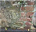
Ripon, 47 Borrage Lane
The benchmark is cut into the roadside wall immediately to the left of the entrance to house number 47.
Image: © Mel Towler Taken: 27 Oct 2022
0.05 miles
8
Ripon, Borrage Lane
There is a benchmark cut into the roadside wall immediately to the left of the entrance to house number 47.
Image: © Mel Towler Taken: 27 Oct 2022
0.06 miles
9
Daffodils beside Mallorie Park Drive
Looking across a park towards the River Laver.
Image: © DS Pugh Taken: 31 Mar 2021
0.06 miles
10
Ripon, River Laver footpath
According to the OS benchmark database there is a rivet benchmark cut into the wall which runs from the bottom of the steps alongside the river. Nothing was found.
Image: © Mel Towler Taken: 27 Oct 2022
0.06 miles
  • ...