IMAGES TAKEN NEAR TO
Borrage Lane, RIPON, HG4 2PW

Introduction

This page details the photographs taken nearby to Borrage Lane, HG4 2PW by members of the Geograph project.

The Geograph project started in 2005 with the aim of publishing, organising and preserving representative images for every square kilometre of Great Britain, Ireland and the Isle of Man.

There are currently over 7.5m images from over14,400 individuals and you can help contribute to the project by visiting https://www.geograph.org.uk

Image Map


Images are licensed for reuse under creativecommons.org/licenses/by-sa/2.0
Notes
  • Clicking on the map will re-center to the selected point.
  • The higher the marker number, the further away the image location is from the centre of the postcode.

Image Listing (128 Images Found)

Images are licensed for reuse under creativecommons.org/licenses/by-sa/2.0
  • ...
Image
Details
Distance
1
Boundary Post
Metal post with the inscription "T&R Williamson Ltd Boundary"; located on Mallorie Park Drive and hidden behind a sign for the Ripon Rugby Union Football Club. The postbox is numbered HG4 38.
Image: © David Rogers Taken: 14 Sep 2010
0.04 miles
2
Mallorie Park Drive (B6265), Ripon
Showing position of Postbox No. HG4 38. See Image] for postbox.
Image: © JThomas Taken: 12 Sep 2020
0.04 miles
3
Ripon, Borrage Lane
According to the OS benchmark database there was a cutmark on the roadside wall, south-west of the gate to the property. There is a small horizontal line on the 3rd course of bricks, but am undecided if this is part of the benchmark. There is no hint of an arrowhead.
Image: © Mel Towler Taken: 27 Oct 2022
0.04 miles
4
Ripon, Borrage Lane
According to the OS benchmark database there was a cutmark on the roadside wall, south-west of the gate to the property. There is a small horizontal line on the 3rd course of bricks on this small curve of the structure. Am undecided if this is part of the benchmark. There is no hint of an arrowhead.
Image: © Mel Towler Taken: 27 Oct 2022
0.04 miles
5
Mallorie Park Drive roadwork lights in the fog
Image: © Colin Pyle Taken: 1 Nov 2015
0.04 miles
6
Elizabeth II postbox on Mallorie Park Drive, Ripon
Postbox No. HG4 38. See Image] for context.
Image: © JThomas Taken: 12 Sep 2020
0.05 miles
7
Mallorie Park Drive, Ripon
Image: © JThomas Taken: 12 Sep 2020
0.05 miles
8
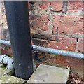
Ripon, 33 Borrage Lane
The benchmark is partially hidden behind the pipework on the exterior of the property, which is on the south side of Borrage Lane.
Image: © Mel Towler Taken: 27 Oct 2022
0.05 miles
9
Ripon, 33 Borrage Lane
There is a benchmark partially hidden behind the pipework on the exterior of the property, which is on the south side of Borrage Lane.
Image: © Mel Towler Taken: 27 Oct 2022
0.05 miles
10
St Wilfred's Well
St Wilfrid's Well is located at the side of Skellbank and below The Spa Gardens. Grade II listed, built in 1762 for W Richardson MD, who was also responsible for the drinking fountain on Harrogate Road. Image
Image: © David Rogers Taken: 9 Jun 2009
0.06 miles
  • ...