
IMAGES TAKEN NEAR TO
Pateley Bridge, HARROGATE, HG3 5AA
Introduction
This page details the photographs taken nearby to HG3 5AA by members of the Geograph project.
The Geograph project started in 2005 with the aim of publishing, organising and preserving representative images for every square kilometre of Great Britain, Ireland and the Isle of Man.

There are currently over 7.5m images from over14,400 individuals and you can help contribute to the project by visiting https://www.geograph.org.uk
Image Map
Images are licensed for reuse under creativecommons.org/licenses/by-sa/2.0
Notes
- Clicking on the map will re-center to the selected point.
- The higher the marker number, the further away the image location is from the centre of the postcode.
Image Listing (14 Images Found)
Images are licensed for reuse under creativecommons.org/licenses/by-sa/2.0
Image
Details
Distance
1
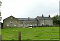
Ivy House Farm
Early 19th century farmhouse and outbuildings. The house (of which this is the rear view) is Listed Grade II.
Image: © Alan Murray-Rust
Taken: 9 Sep 2017
0.07 miles
2
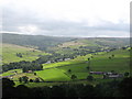
Ivy House Farm
The farm appears in the bottom right hand corner in this Nidderdale view from Wath Bank. The valley of Ashfold Gill is centre picture, with the caravan site prominent.
Image: © Gordon Hatton
Taken: 16 Jul 2008
0.08 miles
3
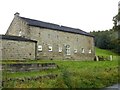
Barn at Ivy House Farm
Now converted to residential accommodation.
Image: © Alan Murray-Rust
Taken: 9 Sep 2017
0.08 miles
6
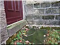
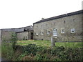
Pateley Bridge, Ivy House Farm
The OS benchmark database shows a cutmark on this older farm building wall. The more recent extension has been built overlapping the wall, and today no cutmark is visible.
Image: © Mel Towler
Taken: 17 Nov 2021
0.12 miles
7
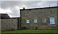
Pateley Bridge, Ivy House Farm
The OS benchmark database shows a cutmark on this older farm building wall, on a lower left hand cornerstone. The more recent extension has been built overlapping the cornerstones, and today no cutmark is visible.
Image: © Mel Towler
Taken: 17 Nov 2021
0.12 miles
9
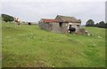
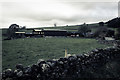
Barn, Grange Lane
An isolated agricultural building guarded by cattle beside the steep road to Heathfield.
Image: © Derek Harper
Taken: 27 Jun 2011
0.17 miles
10
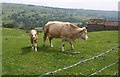
Cow and calf, Grange Lane
High above the Nidd valley. On the right is the barn shown in Image
Image: © Derek Harper
Taken: 27 Jun 2011
0.18 miles