IMAGES TAKEN NEAR TO
Summerbridge, HARROGATE, HG3 4JR
Introduction
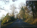
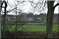
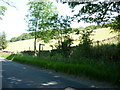
This page details the photographs taken nearby to HG3 4JR by members of the Geograph project.
The Geograph project started in 2005 with the aim of publishing, organising and preserving representative images for every square kilometre of Great Britain, Ireland and the Isle of Man.

There are currently over 7.5m images from over14,400 individuals and you can help contribute to the project by visiting https://www.geograph.org.uk
Image Map
Images are licensed for reuse under creativecommons.org/licenses/by-sa/2.0
Notes
- Clicking on the map will re-center to the selected point.
- The higher the marker number, the further away the image location is from the centre of the postcode.
Image Listing (6 Images Found)
Images are licensed for reuse under creativecommons.org/licenses/by-sa/2.0
Image
Details
Distance
4

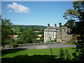
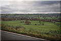
Dougill Hall
Just off the B6165 road south of Summerbridge, this splendid residence has a wonderful prospect of the Nidd Valley
Image: © Chris Heaton
Taken: 6 Jun 2006
0.09 miles