IMAGES TAKEN NEAR TO
Summerbridge, HARROGATE, HG3 4DN
Introduction
This page details the photographs taken nearby to HG3 4DN by members of the Geograph project.
The Geograph project started in 2005 with the aim of publishing, organising and preserving representative images for every square kilometre of Great Britain, Ireland and the Isle of Man.

There are currently over 7.5m images from over14,400 individuals and you can help contribute to the project by visiting https://www.geograph.org.uk
Image Map
Images are licensed for reuse under creativecommons.org/licenses/by-sa/2.0
Notes
- Clicking on the map will re-center to the selected point.
- The higher the marker number, the further away the image location is from the centre of the postcode.
Image Listing (20 Images Found)
Images are licensed for reuse under creativecommons.org/licenses/by-sa/2.0
Image
Details
Distance
1
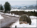
Braisty Woods Farm
Entrance to Braisty Woods Farm near Low Laithe.
Image: © David Rogers
Taken: 9 Feb 2009
0.04 miles
2
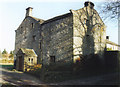
Braisty Woods Farm
Historical home of the Skaife family.
Image: © Cathy Cox
Taken: Unknown
0.09 miles
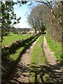
3
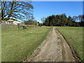
Track approaching Braisty Woods Farm
Track adopted by a footpath approaching Braisty Woods Farm, partially screened by trees, from the west.
Image: © Chris Heaton
Taken: 19 Feb 2012
0.10 miles
4
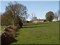
Owen Well House
Seen across a pasture field from footpath number 15 55/74/2.
Image: © Derek Harper
Taken: 5 Apr 2012
0.18 miles
5
View out of Millstone Wood
From footpath 15 55/110/a as it runs close to the western edge of the wood. The milky patch left of centre is due to a flaw in the lens.
Image: © Derek Harper
Taken: 5 Apr 2012
0.18 miles
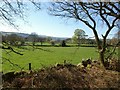
7

Stile by Millstone Wood
Footpath 15 55/110/1 leaves the wood via this stone stile over the wall and crosses the field to meet the road shown in Image near the telegraph pole on the right; the one shown in the other photo is barely discernible beyond it.
Image: © Derek Harper
Taken: 5 Apr 2012
0.21 miles
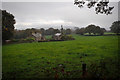
8
Bridleway past Braisty Woods
Looking in the other direction from the same spot as Image, with Owen Well House ahead, and Millstone Wood now on the right.
Image: © Derek Harper
Taken: 5 Apr 2012
0.21 miles
9
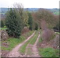
Lane at Hazel Bank
The lane is also a bridleway and descends to the B6165 at New York.
Image: © Gordon Hatton
Taken: 15 Apr 2012
0.22 miles
10
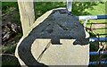
Smelthouses, Brimham Rocks Road
The rivet benchmark is cut into the top of a left hand gatepost at a field entrance on the north side of the road.
Image: © Mel Towler
Taken: 16 Sep 2022
0.22 miles