
IMAGES TAKEN NEAR TO
Low Laithe, HARROGATE, HG3 4DD
Introduction
This page details the photographs taken nearby to HG3 4DD by members of the Geograph project.
The Geograph project started in 2005 with the aim of publishing, organising and preserving representative images for every square kilometre of Great Britain, Ireland and the Isle of Man.

There are currently over 7.5m images from over14,400 individuals and you can help contribute to the project by visiting https://www.geograph.org.uk
Image Map
Images are licensed for reuse under creativecommons.org/licenses/by-sa/2.0
Notes
- Clicking on the map will re-center to the selected point.
- The higher the marker number, the further away the image location is from the centre of the postcode.
Image Listing (60 Images Found)
Images are licensed for reuse under creativecommons.org/licenses/by-sa/2.0
Image
Details
Distance
1
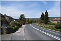
Road out of Low Laithe
The small hamlet has been extended by newer housing.
Image: © Bill Boaden
Taken: 6 May 2013
0.02 miles
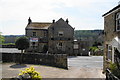
4
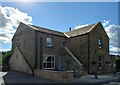
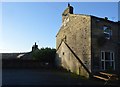
Low Laithe, Ye Old Oak Inn
According to the OS benchmark database there was a benchmark cut into the wall close to the drainpipe. The property was undergoing renovations and possibly a conversion. A new set of stone steps have been built which may have hidden the benchmark. Nothing was found.
Image: © Mel Towler
Taken: 16 Sep 2022
0.03 miles
5
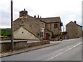
Ye Olde Oak Inn, Low Laithe
A traditional Dales pub beside the B6165. For a close-up of the sign Image
Image: © Maigheach-gheal
Taken: 6 Oct 2010
0.06 miles
6
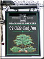
Sign for Ye Olde Oake Inn
From little acorns great oaks grow.
Image: © Maigheach-gheal
Taken: 6 Oct 2010
0.06 miles
7
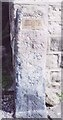
Old Milestone, on the B6165, Low Laithe
Located on the East side of road, at corner of building, on pavement. Metal plate attached to stone post, 18th century. Alternative view see http://www.geograph.org.uk/photo/1246810
Inscription reads: HARTWITH cum WINSLEY / PATELEY BRIDGE 2½ MILES / KNARESBOROUGH 12 MILES / 2000
Milestone Society National ID: YN_KBPB12
Image: © Christine Minto
Taken: 31 Dec 2005
0.08 miles
8
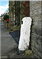
Low Laithe Milestone
"Hartwith cum Winsley, Pateley Bridge 2 1/2 miles, Knaresborough 12 miles. 2000".
Image: © David Rogers
Taken: 2 Apr 2009
0.08 miles
9
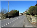
In Low Laithe
B6165 going through the small community of Low Laithe towards Pateley Bridge
Image: © Chris Heaton
Taken: 19 Feb 2012
0.08 miles
10
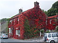
Dusty Miller Restaurant, Low Laithe
The photo would have been even better last week - unfortunately it was raining hard!
Image: © Malcolm Street
Taken: 13 Oct 2005
0.09 miles