
IMAGES TAKEN NEAR TO
Burton Leonard, HARROGATE, HG3 3TE
Introduction
This page details the photographs taken nearby to HG3 3TE by members of the Geograph project.
The Geograph project started in 2005 with the aim of publishing, organising and preserving representative images for every square kilometre of Great Britain, Ireland and the Isle of Man.

There are currently over 7.5m images from over14,400 individuals and you can help contribute to the project by visiting https://www.geograph.org.uk
Image Map
Images are licensed for reuse under creativecommons.org/licenses/by-sa/2.0
Notes
- Clicking on the map will re-center to the selected point.
- The higher the marker number, the further away the image location is from the centre of the postcode.
Image Listing (18 Images Found)
Images are licensed for reuse under creativecommons.org/licenses/by-sa/2.0
Image
Details
Distance
1
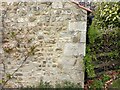
Lime Kiln Barn
Benchmark on converted farm building, about 3 ft from ground level. Good condition.
Image: © Mel Towler
Taken: 9 May 2021
0.03 miles
2
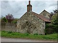
Lime Kiln Barn
End wall alongside bridleway, showing benchmark on right corner.
Image: © Mel Towler
Taken: 9 May 2021
0.03 miles
3
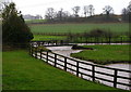
Stainley Beck
Looking across a swollen Stainley Beck towards Rigg Moor.
Image: © David Rogers
Taken: 29 Nov 2009
0.03 miles
5
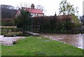
Foot Traffic Only
Stainley Beck in spate has made the ford impassable at Lime Kilns Farm.
Image: © David Rogers
Taken: 29 Nov 2009
0.04 miles
6
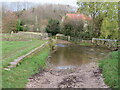
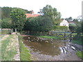
Stainley Beck ford
The bridleway passes through the ford, but a dry alternative is the footbridge on the left. The watercourse here is Stainley Beck, but a short way downstream it becomes Robert Beck.
Image: © Gordon Hatton
Taken: 26 Nov 2020
0.06 miles
7
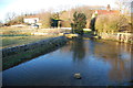
Ford at Burton Leonard
This ford on the Stainley Beck is found along Lime Kilns Lane beside Lime Kilns Farm.
Image: © John Walton
Taken: 8 Feb 2015
0.07 miles
8
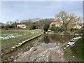
Burton Leonard Ford
This is a second visit to this lovely ford. A link to our previous visit can be viewed at:
https://www.geograph.org.uk/photo/4341764
Image: © John Walton
Taken: 11 Mar 2023
0.07 miles
10
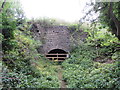
Lime Kiln in Mickle Hill Quarry
The Mickle Hill Quarry now forms part of the Burton Leonard Nature Reserve, that is run by the Yorkshire Wildlife Trust. An archeological survey carried out in 2010 revealed there to be 6 lime kilns on the site in various states of repair, ranging from well-preserved intact masonry structures to near-destroyed earthwork remains. Also found were the remains of three buildings originally associated with the quarry and lime burning business.
The lime burning was carried out between 1838 and 1941, when it stopped because of the danger of rising columns of smoke during the war.
Image: © Matthew Hatton
Taken: 27 Aug 2016
0.09 miles