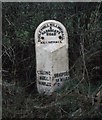
IMAGES TAKEN NEAR TO
Oakridge View, HARROGATE, HG3 2WH

Introduction

This page details the photographs taken nearby to Oakridge View, HG3 2WH by members of the Geograph project.

The Geograph project started in 2005 with the aim of publishing, organising and preserving representative images for every square kilometre of Great Britain, Ireland and the Isle of Man.

There are currently over 7.5m images from over14,400 individuals and you can help contribute to the project by visiting https://www.geograph.org.uk

Image Map


Images are licensed for reuse under creativecommons.org/licenses/by-sa/2.0
Notes
  • Clicking on the map will re-center to the selected point.
  • The higher the marker number, the further away the image location is from the centre of the postcode.

Image Listing (8 Images Found)

Images are licensed for reuse under creativecommons.org/licenses/by-sa/2.0
Image
Details
Distance
1
Oaker Bank Bridge
The bridge is now disused and very overgrown. There is a cut bench mark on the parapet to the right of the photograph but I was unable to find it on this occasion. Bench Mark Database: http://www.bench-marks.org.uk/bm47413
Image: © Mark Anderson Taken: 26 Feb 2013
0.14 miles
2
Harrogate, Oaker Bank Bridge
The benchmark is cut into the eastern parapet of the by-passed Oaker Bank Bridge.
Image: © Mel Towler Taken: 22 Mar 2023
0.14 miles
3
Harrogate, Oaker Bank Bridge
There is a benchmark cut into the eastern parapet of the by-passed Oaker Bank Bridge.
Image: © Mel Towler Taken: 22 Mar 2023
0.14 miles
4
Oaker Bank
Just visible in the middle distance is the parapet of Oaker Bank Bridge which once carried the Dudley Hill Killinghall & Harrogate Road (according to the nearby milepost) over Saltergate Beck.
Image: © David Rogers Taken: 8 Apr 2010
0.15 miles
5
Old Milestone by the B6161, Killinghall
Metal plate attached to stone post by the B6161, in parish of KILLINGHALL (HARROGATE District), Oaker Bank, just South of A59 crossroads, high on banking near fence, on West side of road. WR iron casting, erected by the County Council in the 19th century. Inscription reads:- : KILLING / HALL / 1½ MILES : : DUDLEY HILL.KILLINGHALL / & / HARROGATE / ROAD / KILLINGHALL : : BRADFORD / 19 MILES : Grade II listed. List Entry Number: 1173602 https://historicengland.org.uk/listing/the-list/list-entry/1173602 Milestone Society National ID: YN_BFKH19.
Image: © C Minto Taken: 21 Jul 2006
0.16 miles
6
Milepost - B6161 Oakes Bank - Killinghall (1)
Milepost on the B6161 at Oaker Bank near Killinghall. The milepost is situated high on the grass verge in dense undergrowth a few hundred meters South of the roundabout at the A59 Skipton to Harrogate road junction and is now difficult to see from the roadside. WR Casting. Inscriptions read: DUDLEY HILL KILLINGHALL & HARROGATE ROAD / KILLINGHALL KILLINGHALL 1 1/2 MILES BRADFORD 19 MILES Link to close up photo can be seen below. Image]
Image: © Tez Exley Taken: 21 Oct 2023
0.16 miles
7
Milepost - B6161 Oakes Bank - Killinghall (2)
Milepost on the B6161 at Oaker Bank near Killinghall. The milepost is situated high on the grass verge in dense undergrowth a few hundred meters South of the roundabout at the A59 Skipton to Harrogate road junction and is now difficult to see from the roadside. WR Casting. Inscriptions read: DUDLEY HILL KILLINGHALL & HARROGATE ROAD / KILLINGHALL KILLINGHALL 1 1/2 MILES BRADFORD 19 MILES Link to photo taken from roadside can be seen below. Image]
Image: © Tez Exley Taken: 21 Oct 2023
0.16 miles
8
Milepost on the Dudley Hill - Killinghall Turnpike
This milepost would have been erected around 1838, soon after Otley Road became part of the Turnpike network in Yorkshire. The sign reads: Killinghall 1.5 miles / Bradford 19 miles. There are quite a lot of mileposts dotted around Harrogate due to its emergence as a town in the late 18th - early 19thC.
Image: © Matthew Hatton Taken: 1 Mar 1999
0.23 miles