
IMAGES TAKEN NEAR TO
Tansy Road, HARROGATE, HG3 2UJ
Introduction
This page details the photographs taken nearby to Tansy Road, HG3 2UJ by members of the Geograph project.
The Geograph project started in 2005 with the aim of publishing, organising and preserving representative images for every square kilometre of Great Britain, Ireland and the Isle of Man.

There are currently over 7.5m images from over14,400 individuals and you can help contribute to the project by visiting https://www.geograph.org.uk
Image Map
Images are licensed for reuse under creativecommons.org/licenses/by-sa/2.0
Notes
- Clicking on the map will re-center to the selected point.
- The higher the marker number, the further away the image location is from the centre of the postcode.
Image Listing (10 Images Found)
Images are licensed for reuse under creativecommons.org/licenses/by-sa/2.0
Image
Details
Distance
1
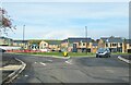
New roundabout on west side of Harrogate
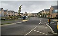
A view from Crowberry Drive on the Jennyfield estate to a new roundabout at the junction with the A59 Skipton Road. Opposite is the new development on the north side of A59 where fields between Oak Beck and the B6161 are being covered by housing.
Image: © Gordon Hatton
Taken: 28 Oct 2020
0.07 miles
3
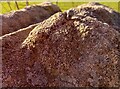
Harrogate, A59
The rivet benchmark is cut into a left hand gatepost on the south side of the A59, alongside the Jennyfield housing estate.
Image: © Mel Towler
Taken: 22 Mar 2023
0.13 miles
4
Harrogate, A59
There is a rivet benchmark cut into the top of the left hand gatepost on the south side of the A59, alongside the Jennyfield housing estate.
Image: © Mel Towler
Taken: 22 Mar 2023
0.13 miles
6
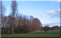
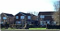
Public open space, Jennyfield
Open area to the east of Crowberry Drive on the Jennyfield estate, Harrogate.
Image: © Gordon Hatton
Taken: 1 Feb 2012
0.16 miles
10
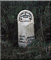
Milepost on the Dudley Hill - Killinghall Turnpike
This milepost would have been erected around 1838, soon after Otley Road became part of the Turnpike network in Yorkshire. The sign reads: Killinghall 1.5 miles / Bradford 19 miles.
There are quite a lot of mileposts dotted around Harrogate due to its emergence as a town in the late 18th - early 19thC.
Image: © Matthew Hatton
Taken: 1 Mar 1999
0.24 miles