
IMAGES TAKEN NEAR TO
Thornthwaite, HARROGATE, HG3 2QS
Introduction
This page details the photographs taken nearby to HG3 2QS by members of the Geograph project.
The Geograph project started in 2005 with the aim of publishing, organising and preserving representative images for every square kilometre of Great Britain, Ireland and the Isle of Man.

There are currently over 7.5m images from over14,400 individuals and you can help contribute to the project by visiting https://www.geograph.org.uk
Image Map
Images are licensed for reuse under creativecommons.org/licenses/by-sa/2.0
Notes
- Clicking on the map will re-center to the selected point.
- The higher the marker number, the further away the image location is from the centre of the postcode.
Image Listing (6 Images Found)
Images are licensed for reuse under creativecommons.org/licenses/by-sa/2.0
Image
Details
Distance

2

Cross base in Brow Wood
An inscribed gritstone block which appears to be a post-medieval wayside cross base with a deep square socket. Local folklore has its use as a plague stone and it could have been repurposed. Its inscription has a cross and below TH16910, but this appears to be upside down relative to its possible use as a cross base. The "0" appears in a smaller size suggesting a date of 1691 post-dating the plague.
It is not recorded in this location on any old OS maps.
Image: © Mick Borroff
Taken: 7 Jan 2021
0.14 miles
3

Cross base in Brow Wood
An inscribed gritstone block which appears to be a post-medieval wayside cross base with a deep square socket. Local folklore has its use as a plague stone and it could have been repurposed. Its inscription has a cross and below TH16910, but this appears to be upside down relative to its use as a cross base. The "0" appears in a smaller size suggesting a date of 1691 post-dating the plague.
It is not recorded in this location on any old OS maps.
It is possibly associated with the Thornthwaite packhorse bridge located some 700m NNE which is thought to date from as early as the 15th century and to be on a packhorse route linking Ilkley to Fountains Abbey and Ripon, possibly constructed by the abbey.
Wayside crosses are one of several types of Christian cross erected during the medieval period, mostly from the 9th to 15th centuries AD. In addition to serving the function of reiterating and reinforcing the Christian faith amongst those who passed the cross and of reassuring the traveller, wayside crosses often fulfilled a role as waymarkers, especially in difficult and otherwise unmarked terrain.
Image: © Mick Borroff
Taken: 7 Jan 2021
0.14 miles
4
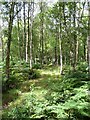
Birch woodland, Thornthwaite
This looks like natural birch woodland with an understorey of holly in places. The footpath runs through here close to Folly Hall.
Image: © Gordon Hatton
Taken: 17 Aug 2011
0.21 miles
5

My Love Lane heading in the direction of Thornthwaite
Looking eastward.
Image: © Peter Wood
Taken: 25 Dec 2019
0.23 miles
6
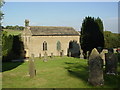
St Saviour's Church, Thornthwaite
Built in 1810 on the site of a much earlier chapel.
"1409 Thornthwaite, 1d new rent of John Pulayn for one dariate of land of new assart (clearing) for a chapel to be built there, to hold him", Extract from Honour of Knaresborough Court Roll.
Image: © Malcolm Street
Taken: 22 Sep 2005
0.24 miles