IMAGES TAKEN NEAR TO
Fringill Lane, HARROGATE, HG3 2PY

Introduction

This page details the photographs taken nearby to Fringill Lane, HG3 2PY by members of the Geograph project.

The Geograph project started in 2005 with the aim of publishing, organising and preserving representative images for every square kilometre of Great Britain, Ireland and the Isle of Man.

There are currently over 7.5m images from over14,400 individuals and you can help contribute to the project by visiting https://www.geograph.org.uk

Image Map


Images are licensed for reuse under creativecommons.org/licenses/by-sa/2.0
Notes
  • Clicking on the map will re-center to the selected point.
  • The higher the marker number, the further away the image location is from the centre of the postcode.

Image Listing (37 Images Found)

Images are licensed for reuse under creativecommons.org/licenses/by-sa/2.0
  • ...
Image
Details
Distance
1
Fringill Mill
The building that was once a busy water powered flax mill is currently being transformed into apartments. The mill was built between 1822 & 1834 and during the later part of the 19th century diversified into rope spinning and flour milling.
Image: © Gordon Hatton Taken: 4 Feb 2008
0.01 miles
2
Darley, Fringill Lane
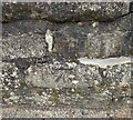
According to the OS benchmark database there is a boulder within the wall or verge that has a cutmark. Too many aggressive brambles to make a thorough search.
Image: © Mel Towler Taken: 26 Aug 2022
0.04 miles
3
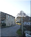
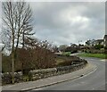
Fringill Lane
Image: © N Chadwick Taken: 21 Aug 2022
0.05 miles
4
Fringill Lane
Image: © N Chadwick Taken: 29 Dec 2015
0.06 miles
5
Darley Primary School
Village school housed in a Victorian building with a 1970's extension off picture to the right.
Image: © Gordon Hatton Taken: 4 Feb 2008
0.06 miles
6
Darley, Main Street
This is the northern parapet of the bridge over the beck in Darley and has a benchmark cut into the 2nd course of stone.
Image: © Mel Towler Taken: 7 Mar 2022
0.07 miles
7
Darley, Main Street
This is the northern parapet of the bridge over the beck in Darley and has a benchmark cut into the 2nd course of stone.
Image: © Mel Towler Taken: 7 Mar 2022
0.07 miles
8
Darley Main Street Bridge
There is a cut bench mark on the parapet to the left of the photograph and a closer view can be seen here: Image
Image: © Mark Anderson Taken: 31 May 2021
0.07 miles
9
Cut Bench Mark, Darley Main Street Bridge
Bench Mark Database: https://www.bench-marks.org.uk/bm148345
Image: © Mark Anderson Taken: 31 May 2021
0.07 miles
10
AA village sign
One of about 10 AA village signs in Yorkshire from the first half of the 20C still in situ in their village. This is preserved on the village school in Darley. Dating from about 1923 it is the most common of the 5 styles of AA village sign in England. They were usually displayed on a smithy/garage or a public house. Most were taken down in 1940. Many were destroyed but a few have been put back and many more are in private collections or museums.
Image: © Chris Minto Taken: 28 Mar 2021
0.08 miles
  • ...