IMAGES TAKEN NEAR TO
Hill Top Lane, HARROGATE, HG3 1PA
Introduction
This page details the photographs taken nearby to Hill Top Lane, HG3 1PA by members of the Geograph project.
The Geograph project started in 2005 with the aim of publishing, organising and preserving representative images for every square kilometre of Great Britain, Ireland and the Isle of Man.

There are currently over 7.5m images from over14,400 individuals and you can help contribute to the project by visiting https://www.geograph.org.uk
Image Map (16 Images)


Getting Data...Please wait
Leaflet Map data © OpenStreetMap
Images are licensed for reuse under creativecommons.org/licenses/by-sa/2.0
Notes
- Clicking on the map will re-center to the selected point.
- The higher the marker number, the further away the image location is from the centre of the postcode.
Image Listing (16 Images Found)
Images are licensed for reuse under creativecommons.org/licenses/by-sa/2.0
Image
Details
Distance
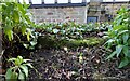
1
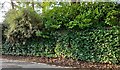
Daw Cross, Hill Top Lane
Behind the plethora of ivy is a roadside wall built against the bank. According to the OS benchmark database there is a benchmark cut into the wall along this short length of wall. The depth of the ivy and constant stream of traffic made it impossible to search.
Image: © Mel Towler
Taken: 3 Jan 2022
0.04 miles
2
Daw Cross, Hill Top Lane
Behind the plethora of ivy is a roadside wall built against the bank on the right hand side of the road. According to the OS benchmark database there is a benchmark cut into the wall along this short length of wall. The depth of the ivy and constant stream of traffic made it impossible to search.
Image: © Mel Towler
Taken: 3 Jan 2022
0.04 miles
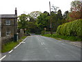
3
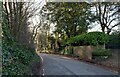
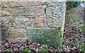
Daw Cross, Hill Top Lane
The worn benchmark is cut into the roadside wall at a wall junction on the west side of the lane.
Image: © Mel Towler
Taken: 7 Apr 2023
0.05 miles
4
Daw Cross, Hill Top Lane
There is a worn benchmark cut into the roadside wall at a wall junction on the west side of the lane. The wall junction is amongst the area of the wall which is covered in the ivy.
Image: © Mel Towler
Taken: 7 Apr 2023
0.05 miles
5
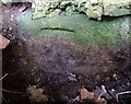
Daw Cross, roadside wall
According to the OS benchmark database on this small roadside wall on Hill Top Lane there is a rivet and benchmark. Nothing was found. The verge alongside the wall is now tended and has been filled in with soil and shrubs, making a sharp corner less dangerous to navigate. This suggests that the mark now may be buried.
Image: © Mel Towler
Taken: 3 Jan 2022
0.07 miles
6
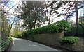
Daw Cross, roadside wall
According to the OS benchmark database there is a rivet and benchmark on this small roadside wall behind and to the left of the road name, Hill Top Lane. Nothing was found. The verge alongside the wall is now tended and has been filled in with soil and shrubs making a sharp corner less dangerous to navigate. This suggests that the mark now may be buried.
Image: © Mel Towler
Taken: 3 Jan 2022
0.07 miles
8
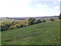
Steep grass field between Brackenthwaite and Daw Cross
Looking north-west, the drop down to the stream is steep.
Image: © Dingdong
Taken: 2 May 2011
0.11 miles
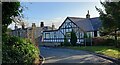
9
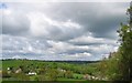
Maw Hill View, Brackenthwaite Lane, Burn Bridge
Close to the Victorian Spa Town of Harrogate, yet very rural setting.
Image: © Roger Crowther
Taken: 8 May 2005
0.14 miles
10
Daw Cross, Bilton Grove Farm
The benchmark is cut into a right hand cornerstone on the east face of the roadside farm building.
Image: © Mel Towler
Taken: 3 Jan 2022
0.16 miles