IMAGES TAKEN NEAR TO
Westminster Close, HARROGATE, HG3 1LT
Introduction
This page details the photographs taken nearby to Westminster Close, HG3 1LT by members of the Geograph project.
The Geograph project started in 2005 with the aim of publishing, organising and preserving representative images for every square kilometre of Great Britain, Ireland and the Isle of Man.

There are currently over 7.5m images from over14,400 individuals and you can help contribute to the project by visiting https://www.geograph.org.uk
Image Map (Loading...)


Getting Data...Please wait
Leaflet Map data © OpenStreetMap
Images are licensed for reuse under creativecommons.org/licenses/by-sa/2.0
Notes
- Clicking on the map will re-center to the selected point.
- The higher the marker number, the further away the image location is from the centre of the postcode.
Image Listing (84 Images Found)
Images are licensed for reuse under creativecommons.org/licenses/by-sa/2.0
Image
Details
Distance
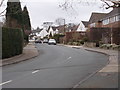
1
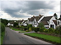
Burn Bridge Oval - looking towards Westminster Drive
Image: © Betty Longbottom
Taken: 19 Mar 2016
0.02 miles
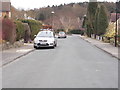
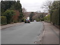
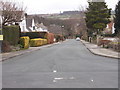
2
Westminster Close - Westminster Drive
Image: © Betty Longbottom
Taken: 19 Mar 2016
0.03 miles
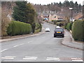
3
Burn Bridge Oval - Westminster Drive
Image: © Betty Longbottom
Taken: 19 Mar 2016
0.05 miles
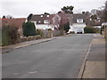
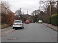
4
Westminster Drive - viewed from Burn Bridge Oval
Image: © Betty Longbottom
Taken: 19 Mar 2016
0.05 miles
5
Westminster Gate - Westminster Drive
Image: © Betty Longbottom
Taken: 19 Mar 2016
0.06 miles
6
Westminster Drive - viewed from Burn Bridge Oval
Image: © Betty Longbottom
Taken: 19 Mar 2016
0.06 miles
7
Westminster Road - Burn Bridge Oval
Image: © Betty Longbottom
Taken: 19 Mar 2016
0.07 miles
8

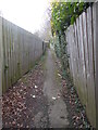
Spring Lane
Looking along Spring Lane in Burn Bridge towards Pannal.
Image: © DS Pugh
Taken: 18 Apr 2022
0.09 miles