
IMAGES TAKEN NEAR TO
Freesia Close, HARROGATE, HG3 1FL
Introduction
This page details the photographs taken nearby to Freesia Close, HG3 1FL by members of the Geograph project.
The Geograph project started in 2005 with the aim of publishing, organising and preserving representative images for every square kilometre of Great Britain, Ireland and the Isle of Man.

There are currently over 7.5m images from over14,400 individuals and you can help contribute to the project by visiting https://www.geograph.org.uk
Image Map
Images are licensed for reuse under creativecommons.org/licenses/by-sa/2.0
Notes
- Clicking on the map will re-center to the selected point.
- The higher the marker number, the further away the image location is from the centre of the postcode.
Image Listing (144 Images Found)
Images are licensed for reuse under creativecommons.org/licenses/by-sa/2.0
Image
Details
Distance
1
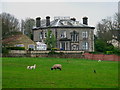
Harlow Grange Farmland
Viewed from The Pinewoods.
Image: © David Rogers
Taken: 10 Apr 2009
0.07 miles
3
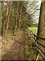
Path through the Pinewoods
A path running along the southeast edge of the pinewoods, which the opposite edge to the main path between Harlow Carr and Harrogate.
Image: © Derek Harper
Taken: 11 Apr 2009
0.10 miles
4
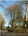
Harlow Pines, Harrogate
A cul-de-sac off the Otley Road. On the right is Harlow Hill Cemetery.
Image: © Derek Harper
Taken: 1 Jan 2019
0.11 miles
5

Farmland on Harlow Hill
Looking out from the pinewoods over a field on Harlow Hill.
Image: © DS Pugh
Taken: 18 Dec 2016
0.11 miles
6
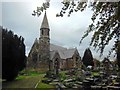
The former All Saints Church , Harlow Hill
Image: © Bill Henderson
Taken: 27 Sep 2014
0.12 miles
7
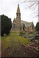
Church of All Saints, Harrogate
I think the church has been disused for a while now. I saw some "for sale" signs a while ago but none on this visit.
Image: © Mark Anderson
Taken: 4 Dec 2014
0.12 miles
8

All Saints' Church
Looking towards the church on Otley Road.
Image: © DS Pugh
Taken: 29 Dec 2020
0.12 miles
9
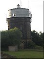
Harlow Hill Water Tower
A significant landmark at Harrogate's highest point, Harlow Hill Water Tower was built in 1902 and overlooks the Harrogate Waterworks and the town.
Image: © Roger Crowther
Taken: 23 Jun 2005
0.12 miles
10
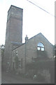
Harlow Hill Observatory
This early Victorian observatory is now a private house, but was open to the public for many years. It retained a dome until the late 20th century.
Image: © Roger Crowther
Taken: 23 Jun 2005
0.12 miles