IMAGES TAKEN NEAR TO
South Drive, HARROGATE, HG2 8AT
Introduction
This page details the photographs taken nearby to South Drive, HG2 8AT by members of the Geograph project.
The Geograph project started in 2005 with the aim of publishing, organising and preserving representative images for every square kilometre of Great Britain, Ireland and the Isle of Man.

There are currently over 7.5m images from over14,400 individuals and you can help contribute to the project by visiting https://www.geograph.org.uk
Image Map
Images are licensed for reuse under creativecommons.org/licenses/by-sa/2.0
Notes
- Clicking on the map will re-center to the selected point.
- The higher the marker number, the further away the image location is from the centre of the postcode.
Image Listing (214 Images Found)
Images are licensed for reuse under creativecommons.org/licenses/by-sa/2.0
Image
Details
Distance
1
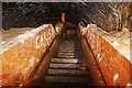
Brunswick tunnel/air raid shelter
Brunswick tunnel was modified and used as an air raid shelter during WWII. these steps lead out near to the Leeds road roundabout. There is a more detailed history of Brunswick tunnel here http://blog.myspace.com/index.cfm?fuseaction=blog.view&friendID=265602590&blogID=351327703
Image: © philld
Taken: 26 Jan 2008
0.04 miles
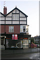
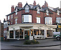
3
Family Chiropractic Clinic - Leeds Road
Image: © Betty Longbottom
Taken: 5 Dec 2009
0.05 miles
5
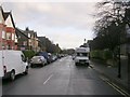
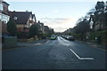
Leeds Road, Harrogate, 1999
This is Leeds Road, the A61, looking south away from Harrogate centre towards Oatlands Mount. Obviously, the road in the foreground in Tewit Well Avenue.
Immediately beyond the traffic lights is St George's roundabout; beneath the roundabout and extending a few hundred yards to the left under Langcliffe Avenue is the 'Harrogate Tunnel' built in the mid-1840s to carry the railway line from York and Wetherby into Harrogate's Brunswick Station. This station was opened in 1848 but closed in 1862 when the railway line was diverted via a cutting in The Stray to a new station in what was becoming the centre of town. Brunswick Station's location is marked by a rough boulder with an attached plaque, opposite Trinity Church.
The position of the start of Harrogate Tunnel near Hornbeam Station can be seen at Image
Image: © Anthony Eden
Taken: Unknown
0.06 miles
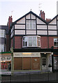
8
Interiors of Harrogate - Leeds Road
Image: © Betty Longbottom
Taken: 5 Dec 2009
0.06 miles
9
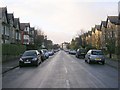
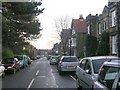
South Drive - viewed from Tewit Well Road
Image: © Betty Longbottom
Taken: 5 Dec 2009
0.06 miles