IMAGES TAKEN NEAR TO
Fifth Avenue Shaws Trailer Park, Knaresborough Road, HARROGATE, HG2 7NJ
Introduction
This page details the photographs taken nearby to Fifth Avenue Shaws Trailer Park, Knaresborough Road, HG2 7NJ by members of the Geograph project.
The Geograph project started in 2005 with the aim of publishing, organising and preserving representative images for every square kilometre of Great Britain, Ireland and the Isle of Man.

There are currently over 7.5m images from over14,400 individuals and you can help contribute to the project by visiting https://www.geograph.org.uk
Image Map
Images are licensed for reuse under creativecommons.org/licenses/by-sa/2.0
Notes
- Clicking on the map will re-center to the selected point.
- The higher the marker number, the further away the image location is from the centre of the postcode.
Image Listing (105 Images Found)
Images are licensed for reuse under creativecommons.org/licenses/by-sa/2.0
Image
Details
Distance
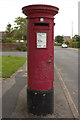
1
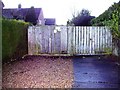
Electricity sub station, Wedderburn Avenue
Image: © Alex McGregor
Taken: 14 Dec 2012
0.06 miles
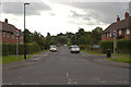
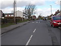
4
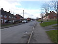
Cawthorn Avenue - Wedderburn Avenue
Image: © Betty Longbottom
Taken: 28 Feb 2017
0.08 miles
5
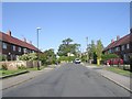
Walworth Avenue - viewed from Kennion Road
Image: © Betty Longbottom
Taken: 26 Sep 2009
0.09 miles
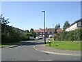
6
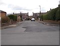
Wedderburn Close - Wedderburn Avenue
Image: © Betty Longbottom
Taken: 28 Feb 2017
0.09 miles
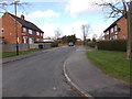
8
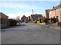
Woodlands Grove - looking towards Wedderburn Avenue
Image: © Betty Longbottom
Taken: 28 Feb 2017
0.10 miles