IMAGES TAKEN NEAR TO
Fairways Avenue, HARROGATE, HG2 7EN
Introduction
This page details the photographs taken nearby to Fairways Avenue, HG2 7EN by members of the Geograph project.
The Geograph project started in 2005 with the aim of publishing, organising and preserving representative images for every square kilometre of Great Britain, Ireland and the Isle of Man.

There are currently over 7.5m images from over14,400 individuals and you can help contribute to the project by visiting https://www.geograph.org.uk
Image Map
Images are licensed for reuse under creativecommons.org/licenses/by-sa/2.0
Notes
- Clicking on the map will re-center to the selected point.
- The higher the marker number, the further away the image location is from the centre of the postcode.
Image Listing (43 Images Found)
Images are licensed for reuse under creativecommons.org/licenses/by-sa/2.0
Image
Details
Distance
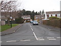
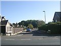
7
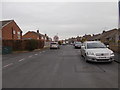
Forest Lane - viewed from Fairways Drive
Image: © Betty Longbottom
Taken: 10 Mar 2017
0.15 miles
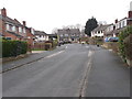
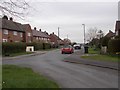
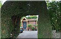
9
Fairways Avenue - viewed from Fairways Close
Image: © Betty Longbottom
Taken: 10 Mar 2017
0.15 miles
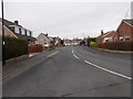
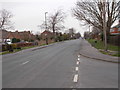
10
Starbeck, 98 Forest Lane
According to the OS benchmark database there is a cutmark on the north-west facing wall of the house. Nothing could be seen from the roadside.
Image: © Mel Towler
Taken: 25 Aug 2022
0.16 miles