IMAGES TAKEN NEAR TO
Greenfields Road, HARROGATE, HG2 7BJ
Introduction
This page details the photographs taken nearby to Greenfields Road, HG2 7BJ by members of the Geograph project.
The Geograph project started in 2005 with the aim of publishing, organising and preserving representative images for every square kilometre of Great Britain, Ireland and the Isle of Man.

There are currently over 7.5m images from over14,400 individuals and you can help contribute to the project by visiting https://www.geograph.org.uk
Image Map
Images are licensed for reuse under creativecommons.org/licenses/by-sa/2.0
Notes
- Clicking on the map will re-center to the selected point.
- The higher the marker number, the further away the image location is from the centre of the postcode.
Image Listing (81 Images Found)
Images are licensed for reuse under creativecommons.org/licenses/by-sa/2.0
Image
Details
Distance
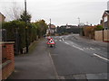
1
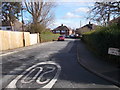
Greenfields Drive - Greenfields Road
Image: © Betty Longbottom
Taken: 28 Feb 2017
0.05 miles
2
Greenfields Road - Woodlands Drive
Image: © Betty Longbottom
Taken: 28 Feb 2017
0.05 miles
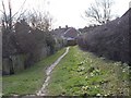
4
Woodlands Walk - viewed from Woodlands Crescent
Image: © Betty Longbottom
Taken: 12 Dec 2016
0.06 miles
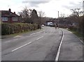
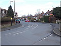
5

Junction of Stonefall Avenue and Woodlands Drive
In the suburbs of Harrogate.
Image: © John Lucas
Taken: 19 Jul 2004
0.07 miles
6
Woodlands Crescent - Woodlands Walk
Image: © Betty Longbottom
Taken: 12 Dec 2016
0.07 miles
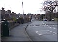
7
Stonefall Avenue - viewed from Woodlands Drive
Image: © Betty Longbottom
Taken: 28 Feb 2017
0.07 miles
8
Woodlands Drive - viewed from Stonefall Avenue
Image: © Betty Longbottom
Taken: 28 Feb 2017
0.07 miles
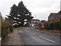
9
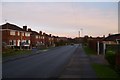
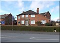
Greenfields Road
A street of houses in Harrogate near Plumpton Park trading estate.
Image: © DS Pugh
Taken: 31 Dec 2013
0.07 miles
10
St Aelred's Presbytery - Woodlands Drive
Image: © Betty Longbottom
Taken: 28 Feb 2017
0.08 miles