IMAGES TAKEN NEAR TO
Lascelles Road, HARROGATE, HG2 0LA
Introduction
This page details the photographs taken nearby to Lascelles Road, HG2 0LA by members of the Geograph project.
The Geograph project started in 2005 with the aim of publishing, organising and preserving representative images for every square kilometre of Great Britain, Ireland and the Isle of Man.

There are currently over 7.5m images from over14,400 individuals and you can help contribute to the project by visiting https://www.geograph.org.uk
Image Map
Images are licensed for reuse under creativecommons.org/licenses/by-sa/2.0
Notes
- Clicking on the map will re-center to the selected point.
- The higher the marker number, the further away the image location is from the centre of the postcode.
Image Listing (166 Images Found)
Images are licensed for reuse under creativecommons.org/licenses/by-sa/2.0
Image
Details
Distance
1
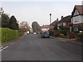
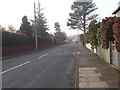
Lascelles Road - viewed from Lascelles Grove
Image: © Betty Longbottom
Taken: 25 Oct 2016
0.01 miles
3
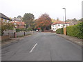
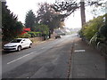
Lascelles Road - viewed from Lascelles Grove
Image: © Betty Longbottom
Taken: 25 Oct 2016
0.04 miles
4

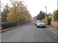
Harlow Oval Court
A residential street off Harlow Oval in the Harlow Hill area of Harrogate.
Image: © DS Pugh
Taken: 30 Dec 2024
0.04 miles
5

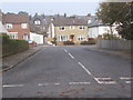
North side of Harlow Oval
A residential street in the Harlow Hill area of Harrogate.
Image: © DS Pugh
Taken: 30 Dec 2024
0.05 miles
6

West side of Harlow Oval
A residential street in the Harlow Hill area of Harrogate.
Image: © DS Pugh
Taken: 30 Dec 2024
0.07 miles
9
Lascelles Grove - Harlow Moor Drive
Image: © Betty Longbottom
Taken: 25 Oct 2016
0.08 miles
10
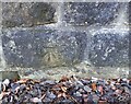
Harrogate, Lascelles Grove
The benchmark is cut into the north-east facing roadside wall.
Image: © Mel Towler
Taken: 27 Jan 2022
0.08 miles