
IMAGES TAKEN NEAR TO
Franklin Road, HARROGATE, HG1 5EE
Introduction
This page details the photographs taken nearby to Franklin Road, HG1 5EE by members of the Geograph project.
The Geograph project started in 2005 with the aim of publishing, organising and preserving representative images for every square kilometre of Great Britain, Ireland and the Isle of Man.

There are currently over 7.5m images from over14,400 individuals and you can help contribute to the project by visiting https://www.geograph.org.uk
Image Map
Images are licensed for reuse under creativecommons.org/licenses/by-sa/2.0
Notes
- Clicking on the map will re-center to the selected point.
- The higher the marker number, the further away the image location is from the centre of the postcode.
Image Listing (469 Images Found)
Images are licensed for reuse under creativecommons.org/licenses/by-sa/2.0
Image
Details
Distance
1
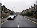
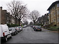
Mayfield Grove - viewed from Mayfield Place
Image: © Betty Longbottom
Taken: 25 Jan 2010
0.02 miles
3
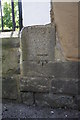
Benchmark on the side of #67 Franklin Road
Ordnance Survey cut mark benchmark described on the Bench Mark Database at http://www.bench-marks.org.uk/bm31689
Image: © Roger Templeman
Taken: 24 May 2012
0.03 miles
4
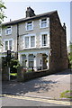
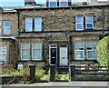
'Murray House', #67 Franklin Road
There is an OS benchmark Image on a corner stone of the porch jut on the side of the house
Image: © Roger Templeman
Taken: 24 May 2012
0.03 miles
5

Harrogate, Mayfield Grove
This is the gatepost which stands between the pathways to the properties 27 and 29 Mayfield Grove, and is on the west side of the road. There is a benchmark cut into the post.
Image: © Mel Towler
Taken: 8 Aug 2021
0.04 miles
6
Harrogate, Mayfield Grove
A wider angle showing the gatepost which stands between the pathways to the properties 27 and 29 Mayfield Grove, which are located on the west side of the road. There is a benchmark cut into the central post in this photo.
Image: © Mel Towler
Taken: 8 Aug 2021
0.04 miles

10
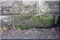
Benchmark on the wall of Franklin Road
Ordnance Survey cut mark benchmark described on the Bench Mark Database at http://www.bench-marks.org.uk/bm43167
Image: © Roger Templeman
Taken: 24 May 2012
0.05 miles