IMAGES TAKEN NEAR TO
Hurstleigh Terrace, HARROGATE, HG1 4TF
Introduction
This page details the photographs taken nearby to Hurstleigh Terrace, HG1 4TF by members of the Geograph project.
The Geograph project started in 2005 with the aim of publishing, organising and preserving representative images for every square kilometre of Great Britain, Ireland and the Isle of Man.

There are currently over 7.5m images from over14,400 individuals and you can help contribute to the project by visiting https://www.geograph.org.uk
Image Map
Images are licensed for reuse under creativecommons.org/licenses/by-sa/2.0
Notes
- Clicking on the map will re-center to the selected point.
- The higher the marker number, the further away the image location is from the centre of the postcode.
Image Listing (160 Images Found)
Images are licensed for reuse under creativecommons.org/licenses/by-sa/2.0
Image
Details
Distance
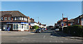
2
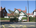
Shamrock Veterinary Clinic - Knaresborough Road
Image: © Betty Longbottom
Taken: 26 Sep 2009
0.03 miles
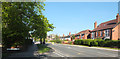
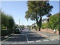
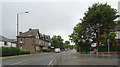
4
Hurstleigh Terrace - Birstwith Road
Image: © Betty Longbottom
Taken: 26 Sep 2009
0.05 miles
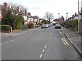
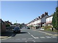
5
Roseville Road - Knaresborough Road
Image: © Betty Longbottom
Taken: 26 Sep 2009
0.05 miles
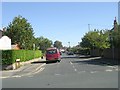
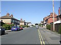
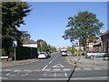
6
Knaresborough Road, Harrogate
Birstwith Road joins Knaresborough Road from the right.
Image: © habiloid
Taken: 28 Jul 2018
0.05 miles
7
Birstwith Road - Knaresborough Road
Image: © Betty Longbottom
Taken: 26 Sep 2009
0.05 miles