IMAGES TAKEN NEAR TO
Poplar Grove, HARROGATE, HG1 4PW
Introduction
This page details the photographs taken nearby to Poplar Grove, HG1 4PW by members of the Geograph project.
The Geograph project started in 2005 with the aim of publishing, organising and preserving representative images for every square kilometre of Great Britain, Ireland and the Isle of Man.

There are currently over 7.5m images from over14,400 individuals and you can help contribute to the project by visiting https://www.geograph.org.uk
Image Map (Loading...)


Getting Data...Please wait
Leaflet Map data © OpenStreetMap
Images are licensed for reuse under creativecommons.org/licenses/by-sa/2.0
Notes
- Clicking on the map will re-center to the selected point.
- The higher the marker number, the further away the image location is from the centre of the postcode.
Image Listing (37 Images Found)
Images are licensed for reuse under creativecommons.org/licenses/by-sa/2.0
Image
Details
Distance
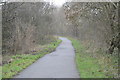
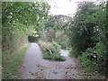
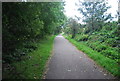
2
Path to Woodfield Road, Harrogate
Leading down from the cycle route along the former Nidd Valley railway line. Footpath 15 54/13/1 crosses the cycle path and continues to Old Bilton.
Image: © Derek Harper
Taken: 5 Jul 2014
0.08 miles
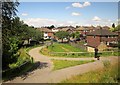
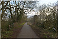
4
National Cycle Network route 67, Harrogate
The path to the left is shared by pedestrians and cyclists, and follows the course of a dismantled railway. It forms part of the route of the National Cycle Network. The path to the right descends into a housing estate, providing access onto and from the railway path.
Image: © Malc McDonald
Taken: 14 Oct 2021
0.10 miles
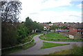
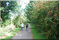
5
The Nidderdale Greenway near Bilton, Harrogate
Image: © habiloid
Taken: 14 Jan 2023
0.10 miles
6
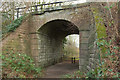
Path beneath disused railway, Bilton
Footpath 15 54/13/1 goes through the embankment of the former Nidd Valley Railway, now carrying the Nidderdale Greenway and NCN67. The footpath can be seen leading to the bridge as a grass path in the centre of Image; that is behind the camera here.
Image: © Derek Harper
Taken: 26 Dec 2017
0.10 miles
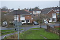
9
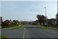
Woodfield Road and Poplar Crescent
Looking along Woodfield Road with Poplar Crescent to the left.
Image: © DS Pugh
Taken: 17 Apr 2022
0.11 miles