IMAGES TAKEN NEAR TO
Century Walk, HARROGATE, HG1 4NN
Introduction
This page details the photographs taken nearby to Century Walk, HG1 4NN by members of the Geograph project.
The Geograph project started in 2005 with the aim of publishing, organising and preserving representative images for every square kilometre of Great Britain, Ireland and the Isle of Man.

There are currently over 7.5m images from over14,400 individuals and you can help contribute to the project by visiting https://www.geograph.org.uk
Image Map (Loading...)


Getting Data...Please wait
Leaflet Map data © OpenStreetMap
Images are licensed for reuse under creativecommons.org/licenses/by-sa/2.0
Notes
- Clicking on the map will re-center to the selected point.
- The higher the marker number, the further away the image location is from the centre of the postcode.
Image Listing (90 Images Found)
Images are licensed for reuse under creativecommons.org/licenses/by-sa/2.0
Image
Details
Distance
1
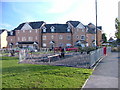
New housing on the site of the old Harrogate Hospital.
I can't be sure but I think that the houses pictured are where A & E used to be.
Image: © Robin Hall
Taken: 19 Nov 2005
0.03 miles
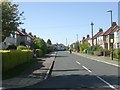
2
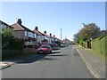
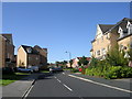
Kendal Road - viewed from Coniston Road
Image: © Betty Longbottom
Taken: 26 Sep 2009
0.05 miles
5
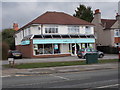
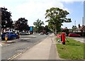
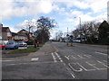
Lloyds Pharmacy - Knaresborough Road
Image: © Betty Longbottom
Taken: 28 Feb 2017
0.07 miles
6
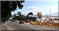
Construction at Lidl, Knaresborough Road (A59), Harrogate
Image: © habiloid
Taken: 17 Sep 2022
0.07 miles
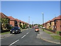
8
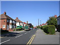
Knaresborough Road - viewed from Rydal Road
Image: © Betty Longbottom
Taken: 28 Feb 2017
0.09 miles
9
Nightingale Drive - Swarcliffe Road
Image: © Betty Longbottom
Taken: 26 Sep 2009
0.09 miles