
IMAGES TAKEN NEAR TO
French Street, HARROGATE, HG1 4DA
Introduction
This page details the photographs taken nearby to French Street, HG1 4DA by members of the Geograph project.
The Geograph project started in 2005 with the aim of publishing, organising and preserving representative images for every square kilometre of Great Britain, Ireland and the Isle of Man.

There are currently over 7.5m images from over14,400 individuals and you can help contribute to the project by visiting https://www.geograph.org.uk
Image Map
Images are licensed for reuse under creativecommons.org/licenses/by-sa/2.0
Notes
- Clicking on the map will re-center to the selected point.
- The higher the marker number, the further away the image location is from the centre of the postcode.
Image Listing (105 Images Found)
Images are licensed for reuse under creativecommons.org/licenses/by-sa/2.0
Image
Details
Distance
1
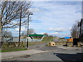
New Cycle Bridge
The recently installed cycle bridge over the railway line, linking into the Starbeck & Knaresborough cycle routes.
Image: © DS Pugh
Taken: 31 Mar 2006
0.01 miles
2
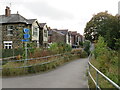
National Cycle Network route 67, Harrogate
This path is a ramp leading down to street level from a bridge across an adjacent railway line. The path is shared by pedestrians and cyclists, and forms part of the route of National Cycle Network route 67.
Image: © Malc McDonald
Taken: 14 Oct 2021
0.01 miles
3
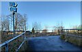
Harrogate, path leading to footbridge over rail line
According to the OS benchmark database there was a benchmark cut into concrete steps which led to the footbridge over the railway line. There are no steps at the given grid reference, and no benchmark was found.
Image: © Mel Towler
Taken: 13 Jan 2022
0.01 miles
4
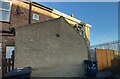
Harrogate, French Street
According to the OS benchmark database there is a benchmark cut into the wall of 15 French Street. The exterior of the property has been rendered and no benchmark is visible.
Image: © Mel Towler
Taken: 13 Jan 2022
0.02 miles
6
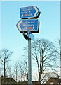
Signs on the Nidderdale Greenway
At a footpath junction that is now really a dual use path junction, since the Greenway carries NCN67. The houses are across the railway on Woodfield Close. Behind the camera and to the right is footpath 15 54/101/2.
Image: © Derek Harper
Taken: 26 Dec 2017
0.02 miles
7
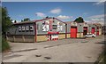
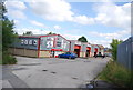
Claro Way, Harrogate
The businesses advertised in Image], seen from footpath 15 54/101/2, which keeps left of here.
Image: © Derek Harper
Taken: 5 Jul 2014
0.02 miles
8
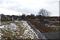
Harrogate Railway
Looking along the line to Harrogate from Dragon Junction. The signal on the left is the up distant signal for Harrogate, H21.
Image: © DS Pugh
Taken: 29 Mar 2013
0.02 miles
9
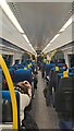
1743 departure from York
The interior of 170472 as it approaches Harrogate operating the 1743 York to Leeds service (2C59). This is the rearmost of the three carriages.
Image: © DS Pugh
Taken: 9 Dec 2022
0.03 miles
10
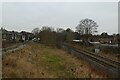
Beside the railway
There used to be rail lines to the left of the current up and down lines serving Claro. The signal on the right is the distant for Starbeck, S4.
Image: © DS Pugh
Taken: 21 Dec 2021
0.03 miles