IMAGES TAKEN NEAR TO
Bank End, HOLMFIRTH, HD9 7BE
Introduction
This page details the photographs taken nearby to Bank End, HD9 7BE by members of the Geograph project.
The Geograph project started in 2005 with the aim of publishing, organising and preserving representative images for every square kilometre of Great Britain, Ireland and the Isle of Man.

There are currently over 7.5m images from over14,400 individuals and you can help contribute to the project by visiting https://www.geograph.org.uk
Image Map
Images are licensed for reuse under creativecommons.org/licenses/by-sa/2.0
Notes
- Clicking on the map will re-center to the selected point.
- The higher the marker number, the further away the image location is from the centre of the postcode.
Image Listing (15 Images Found)
Images are licensed for reuse under creativecommons.org/licenses/by-sa/2.0
Image
Details
Distance
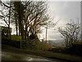
4
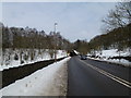
Thurstonland Bank Road - viewed from Oakes Avenue
Image: © Betty Longbottom
Taken: 15 Mar 2017
0.20 miles
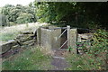
5
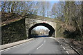
Holmfirth Branch Line bridge
Bridge on the former Holmfirth Branch Line
Image: © Adam Brookes
Taken: 9 Mar 2010
0.20 miles
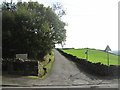
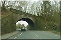
7
Road Bridge on the dismantled Holmfirth Branch Line
Image: © SMJ
Taken: 27 Mar 2013
0.22 miles
9
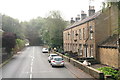
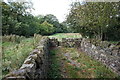
Cottages by the A616 near Mytholm Bridge and Thongsbridge
Bridge over disused railway in the distance.
Image: © Chris
Taken: 11 Sep 2014
0.22 miles
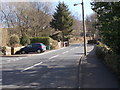
10
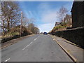
Oakes Avenue - Thurstonland Bank Road
Image: © Betty Longbottom
Taken: 15 Mar 2017
0.22 miles