IMAGES TAKEN NEAR TO
Kistvaen Gardens, HOLMFIRTH, HD9 5NQ
Introduction
This page details the photographs taken nearby to Kistvaen Gardens, HD9 5NQ by members of the Geograph project.
The Geograph project started in 2005 with the aim of publishing, organising and preserving representative images for every square kilometre of Great Britain, Ireland and the Isle of Man.

There are currently over 7.5m images from over14,400 individuals and you can help contribute to the project by visiting https://www.geograph.org.uk
Image Map
Images are licensed for reuse under creativecommons.org/licenses/by-sa/2.0
Notes
- Clicking on the map will re-center to the selected point.
- The higher the marker number, the further away the image location is from the centre of the postcode.
Image Listing (44 Images Found)
Images are licensed for reuse under creativecommons.org/licenses/by-sa/2.0
Image
Details
Distance
1
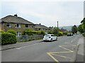
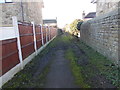
Kistvaen Gardens - Birmingham Lane
Image: © Betty Longbottom
Taken: 29 Oct 2010
0.03 miles
2
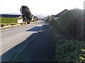
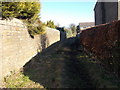
Birmingham Lane - Slaithwaite Road
Image: © Betty Longbottom
Taken: 29 Oct 2010
0.06 miles
3
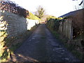
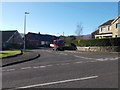
Birmingham Lane
With housing opposite a primary school with its obligatory road markings
Image: © Kevin Waterhouse
Taken: 12 May 2024
0.07 miles
6
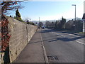
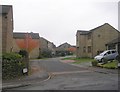
Slaithwaite Road - viewed from Moor View
Image: © Betty Longbottom
Taken: 20 Jan 2017
0.09 miles
8
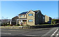
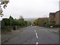
House on Slaithwaite Road, Meltham
At the junction with Hassocks Road.
Image: © JThomas
Taken: 15 Nov 2018
0.10 miles