IMAGES TAKEN NEAR TO
Colders Lane, HOLMFIRTH, HD9 4HZ
Introduction
This page details the photographs taken nearby to Colders Lane, HD9 4HZ by members of the Geograph project.
The Geograph project started in 2005 with the aim of publishing, organising and preserving representative images for every square kilometre of Great Britain, Ireland and the Isle of Man.

There are currently over 7.5m images from over14,400 individuals and you can help contribute to the project by visiting https://www.geograph.org.uk
Image Map
Images are licensed for reuse under creativecommons.org/licenses/by-sa/2.0
Notes
- Clicking on the map will re-center to the selected point.
- The higher the marker number, the further away the image location is from the centre of the postcode.
Image Listing (37 Images Found)
Images are licensed for reuse under creativecommons.org/licenses/by-sa/2.0
Image
Details
Distance
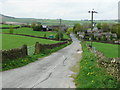
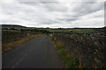
2
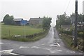
Leygards Lane, Meltham
Why is the road unsuitable for large vehicles? There is a farm in the distance. The photo is taken from the Wesseden Head Road junction
Image: © Richard Kay
Taken: 9 Jun 2010
0.04 miles
3
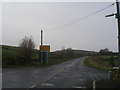
Weather warning sign on Wessenden Head Road
Image: © John Slater
Taken: 24 Nov 2012
0.04 miles
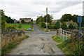
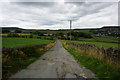
4
Bedlam Road, Meltham
This meets Wessenden Head Road at a cross roads in the middle distance. The road straight forward at the cross roads is Leygards Lane. Bedlam Road is a private road and public footpath.
Image: © Humphrey Bolton
Taken: 28 Apr 2014
0.06 miles
6
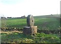
Peak District National Park Boundary Marker
Image: © Anthony Parkes
Taken: 21 Dec 2013
0.08 miles
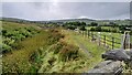
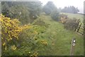
7
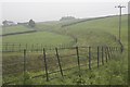
Catchwater Drain from Wessenden Head Road
This is the eastern section of a catchwater drain, about 3km long, feeding Blackmoorfoot reservoir SE098126
Image: © Richard Kay
Taken: 9 Jun 2010
0.10 miles
9
Feeder Catchwater drain to Blackmoorfoot Conduit
Although un-named on the map, this contour catchwater drain links with the Blackmoorfoot conduit at SE087114. The Meltham Way footpath runs alongside the drain.
Image: © Richard Kay
Taken: 9 Jun 2010
0.11 miles