IMAGES TAKEN NEAR TO
Royd Road, HOLMFIRTH, HD9 4BE
Introduction
This page details the photographs taken nearby to Royd Road, HD9 4BE by members of the Geograph project.
The Geograph project started in 2005 with the aim of publishing, organising and preserving representative images for every square kilometre of Great Britain, Ireland and the Isle of Man.

There are currently over 7.5m images from over14,400 individuals and you can help contribute to the project by visiting https://www.geograph.org.uk
Image Map
Images are licensed for reuse under creativecommons.org/licenses/by-sa/2.0
Notes
- Clicking on the map will re-center to the selected point.
- The higher the marker number, the further away the image location is from the centre of the postcode.
Image Listing (17 Images Found)
Images are licensed for reuse under creativecommons.org/licenses/by-sa/2.0
Image
Details
Distance

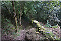
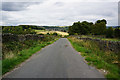
3
Harden Moss Road at Magdalen Road, Meltham
This is the end of the public road; Harden Moss Road and Magdalen Road are bridleways.
Image: © Humphrey Bolton
Taken: 16 May 2016
0.08 miles
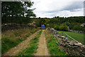
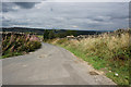
8
Magdalen Road passing Royd Farm, Meltham
Royd Farm is first shown on the 1906 1:2500 map. the house and bungalow were built later.
Image: © Humphrey Bolton
Taken: 16 May 2016
0.17 miles
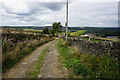
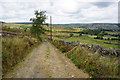
9
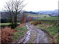
Harden Hill Road
Looking Back towards Meltham
Image: © Nigel Homer
Taken: 26 Feb 2006
0.19 miles