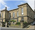
IMAGES TAKEN NEAR TO
Market Street, HOLMFIRTH, HD9 3HW

Introduction

This page details the photographs taken nearby to Market Street, HD9 3HW by members of the Geograph project.

The Geograph project started in 2005 with the aim of publishing, organising and preserving representative images for every square kilometre of Great Britain, Ireland and the Isle of Man.

There are currently over 7.5m images from over14,400 individuals and you can help contribute to the project by visiting https://www.geograph.org.uk

Image Map


Images are licensed for reuse under creativecommons.org/licenses/by-sa/2.0
Notes
  • Clicking on the map will re-center to the selected point.
  • The higher the marker number, the further away the image location is from the centre of the postcode.

Image Listing (381 Images Found)

Images are licensed for reuse under creativecommons.org/licenses/by-sa/2.0
  • ...
Image
Details
Distance
1
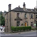
Holme Valley Osteopathy - Huddersfield Road
Image: © Betty Longbottom Taken: 11 Aug 2010
0.00 miles
2
Holmfirth Dental Surgery - Huddersfield Road
Image: © Betty Longbottom Taken: 20 Jul 2007
0.01 miles
3
Drill Hall - Huddersfield Road
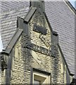
The inscription over the door reads: '2nd VBDWWR Regt' - which means 2nd Volunteer Battalion Duke of Wellington's West Riding Regiment.
Image: © Betty Longbottom Taken: 20 Jul 2007
0.01 miles
4
Community Fire Station - Huddersfield Road
Image: © Betty Longbottom Taken: 20 Jul 2007
0.02 miles
5
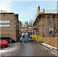
Town Hall Street, Holmfirth
Image: © habiloid Taken: 30 Dec 2020
0.02 miles
6
Former Drill Hall #1
Holmfirth's Drill Hall opened its doors in 1892 and was built to meet the growing and changing needs of those in the 2nd Volunteer Battalion West Riding Regiment. The origins of this battalion lay in the Holmfirth Volunteer Rifle Corps, established in 1860.
Image: © Mike Kirby Taken: 23 Apr 2014
0.02 miles
7
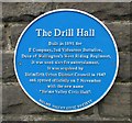
Former Drill Hall, #2
Holme Valley Civic Society, blue plaque.
Image: © Mike Kirby Taken: 23 Apr 2014
0.02 miles
8
Former Drill Hall, #3
The name of the regiment carved in stone.
Image: © Mike Kirby Taken: 23 Apr 2014
0.02 miles
9
Former Drill Hall #4 (and Town Hall)
In 1947, a new Drill Hall was built further down Huddersfield Road. The former Drill Hall, (to left), was then combined with the Town Hall, a grade II listed building, dated 1842, to create the present Holmfirth Civic Hall. LBS No: 340396
Image: © Mike Kirby Taken: 23 Apr 2014
0.02 miles
10
Holmfirth, The Postcard
The Postcard public house at the corner of Crown Lane and Huddersfield Road (A6024). Presumably, the (unusual) pub name is a reference to the famous Bamforth's 'saucy seaside' postcards which were manufactured in the town between 1910-1980.
Image: © David Dixon Taken: 17 Feb 2013
0.02 miles
  • ...