IMAGES TAKEN NEAR TO
Wood Street, HOLMFIRTH, HD9 3ED
Introduction
This page details the photographs taken nearby to Wood Street, HD9 3ED by members of the Geograph project.
The Geograph project started in 2005 with the aim of publishing, organising and preserving representative images for every square kilometre of Great Britain, Ireland and the Isle of Man.

There are currently over 7.5m images from over14,400 individuals and you can help contribute to the project by visiting https://www.geograph.org.uk
Image Map
Images are licensed for reuse under creativecommons.org/licenses/by-sa/2.0
Notes
- Clicking on the map will re-center to the selected point.
- The higher the marker number, the further away the image location is from the centre of the postcode.
Image Listing (103 Images Found)
Images are licensed for reuse under creativecommons.org/licenses/by-sa/2.0
Image
Details
Distance
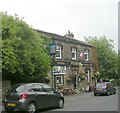
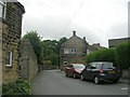
1

Clothiers arms.
Public house in Netherthong.
Image: © steven ruffles
Taken: 14 Jul 2015
0.02 miles
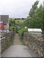
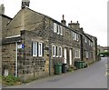
3
Giles Street - viewed from School Lane
Image: © Betty Longbottom
Taken: 17 Jul 2010
0.02 miles
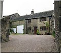
4
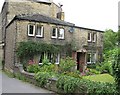
Cottages in Giles Street, next to the Post Office
Image: © Alan Longbottom
Taken: 17 Jul 2010
0.03 miles
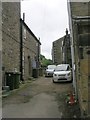
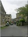
10
Church Street - viewed from Giles Street
Image: © Betty Longbottom
Taken: 17 Jul 2010
0.04 miles