IMAGES TAKEN NEAR TO
Digley Road, HOLMFIRTH, HD9 2QN

Introduction

This page details the photographs taken nearby to Digley Road, HD9 2QN by members of the Geograph project.

The Geograph project started in 2005 with the aim of publishing, organising and preserving representative images for every square kilometre of Great Britain, Ireland and the Isle of Man.

There are currently over 7.5m images from over14,400 individuals and you can help contribute to the project by visiting https://www.geograph.org.uk

Image Map


Images are licensed for reuse under creativecommons.org/licenses/by-sa/2.0
Notes
  • Clicking on the map will re-center to the selected point.
  • The higher the marker number, the further away the image location is from the centre of the postcode.

Image Listing (55 Images Found)

Images are licensed for reuse under creativecommons.org/licenses/by-sa/2.0
  • ...
Image
Details
Distance
1
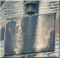
Plaque on former National School, Holmbridge, Austonley
Erected by voluntary contribution aided by grants from the National Society and the Committee of Council on Education 1841. This was a committee of the Privy Council concerned with the State's interest in public elementary education from 1839 onwards.
Image: © Humphrey Bolton Taken: 8 Jan 2009
0.04 miles
2
Former National School, Field End Lane, Holmbridge, Austonley
Now a house. Still shown as a school on a six-inch map of about 1960. For plaque see Image
Image: © Humphrey Bolton Taken: 8 Jan 2009
0.04 miles
3
Riverside walk, Holmbridge
Image: © John Constantinoff Taken: 9 May 2009
0.06 miles
4
Field path, Holmbridge
Path just above village of Holmbridge.
Image: © Samantha Waddington Taken: 12 Jan 2013
0.08 miles
5
Field End Farm
Image: © Peter McDermott Taken: 27 Jun 2015
0.09 miles
6
Holmbridge CC, Tour de France
Holmbridge Cricket Club, providing refreshments to spectators the day the Tour de France came to Holmbridge.
Image: © John Moorhouse Taken: 6 Jul 2014
0.10 miles
7
Holmbridge cricket ground
Image: © Chris Morgan Taken: 16 Oct 2018
0.11 miles
8
Cricket Match at Holmebridge
The western edge of this grid square cuts through the cricket pitch roughly where the square is situated. Meanwhile the young bowler walking back to his mark was about to deliver a flailing wide down the leg side.
Image: © Jonathan Clitheroe Taken: 25 Jul 2015
0.11 miles
9
Holmbridge Cricket Club
Image: © SMJ Taken: 26 Apr 2009
0.12 miles
10
St David's Church, Holmbridge
This view from the car park shows the seven tall lancet windows at the south side of the nave. Pevsner records that the chancel was added in 1887.
Image: © Humphrey Bolton Taken: 23 Jul 2009
0.12 miles
  • ...