1
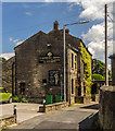
Towards Black Sike Dike and Booth House
Image: © Glyn Drury
Taken: 7 Aug 2009
0.05 miles
2
Liphill Bank
View looking across Black Sike Dike at Liphill Bank.
Image: © Peter McDermott
Taken: 27 Jun 2015
0.07 miles
3
A635 Greenfield Road at Holmfirth boundary
Image: © Colin Pyle
Taken: 19 Nov 2017
0.10 miles
4
Liphill Bank
Old mill at Liphill Bank.
Image: © Peter McDermott
Taken: 27 Jun 2015
0.11 miles
5
Bus in Parkhead turning circle, Holmfirth
First West Yorkshire 30731, a Leyland Olympian/Northern Counties new to Capital Citybus, stands in a superbly situated turning circle perched on a hillside off Greenfield Road just beyond the western edge of Holmfirth, overlooking the Holme valley. It has just worked a journey on route 312 from Huddersfield.
Image: © Richard Vince
Taken: 26 Apr 2008
0.11 miles
6
Old Milestone by the A635, Greenfield Road, west of Holmfirth
Metal plate attached to stone post by the A635, in parish of Holme Valley (Kirklees District), Greenfield Road, Upperthorpe, Holmfirth, by electricity pylon 196, just above bus turning circle on opposite side of road, on North side of road. Brayshaw & Booth iron casting, erected by the County Council in the 19th century.
Inscription reads:-
: HOLMFIRTH / 1 MILE / BARNSLEY / 15 MILES : : GREENFIELD & SHEPLEY / LANE HEAD / ROAD / UPPERTHONG : : GREEN / FIELD / 9½ MILES / OLDHAM / 13¾ MILES :
Maker:-
: BRAYSHAW & BOOTH / MAKERS / LIVERSEDGE :
Grade II Listed.
List Entry Number: 1134872 https://historicengland.org.uk/listing/the-list/list-entry/1134872
Milestone Society National ID: YW_GFSLH09
Image: © C Minto
Taken: 25 Sep 2002
0.13 miles
7
Old Milestone by the A635, Greenfield Road, west of Holmfirth
Metal plate attached to stone post by the A635, in parish of Holme Valley (Kirklees District), Greenfield Road, Upperthorpe, Holmfirth, by electricity pylon 196, just above bus turning circle on opposite side of road, on North side of road. Brayshaw & Booth iron casting, erected by the County Council in the 19th century. An earlier photograph can be seen here https://www.geograph.org.uk/photo/6102142.
Inscription reads:-
: HOLMFIRTH / 1 MILE / BARNSLEY / 15 MILES : : GREENFIELD & SHEPLEY / LANE HEAD / ROAD / UPPERTHONG : : GREEN / FIELD / 9½ MILES / OLDHAM / 13¾ MILES :
Maker:-
: BRAYSHAW & BOOTH / MAKERS / LIVERSEDGE :
Grade II Listed.
List Entry Number: 1134872 https://historicengland.org.uk/listing/the-list/list-entry/1134872
Milestone Society National ID: YW_GFSLH09
Image: © Nigel Upton
Taken: 24 Sep 2022
0.13 miles
8
Farmers Arms
The Framers Arms public house in Holmfirth.
Image: © Peter McDermott
Taken: 27 Jun 2015
0.19 miles
9
Flat Lane, Upperthong
Heading along track past Nether House farm, west of Upperthong. The 'tops' of Holme Moss can be seen in the distance.
Image: © Samantha Waddington
Taken: 13 Apr 2013
0.24 miles


