IMAGES TAKEN NEAR TO
Longley, HOLMFIRTH, HD9 2JD
Introduction
This page details the photographs taken nearby to Longley, HD9 2JD by members of the Geograph project.
The Geograph project started in 2005 with the aim of publishing, organising and preserving representative images for every square kilometre of Great Britain, Ireland and the Isle of Man.

There are currently over 7.5m images from over14,400 individuals and you can help contribute to the project by visiting https://www.geograph.org.uk
Image Map
Images are licensed for reuse under creativecommons.org/licenses/by-sa/2.0
Notes
- Clicking on the map will re-center to the selected point.
- The higher the marker number, the further away the image location is from the centre of the postcode.
Image Listing (29 Images Found)
Images are licensed for reuse under creativecommons.org/licenses/by-sa/2.0
Image
Details
Distance
2
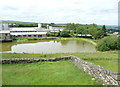
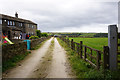
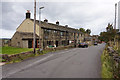
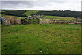
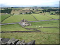
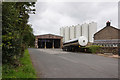
Longley Farm, Holmfirth
Longley Farm make dairy products. I've been eating their yogurts for decades - real yogurt without starch, plain or with added fruit. I thought that there must have been a mill here, but the pond is not shown on the 1980 1:10000 map.
Image: © Humphrey Bolton
Taken: 14 Jun 2019
0.02 miles