IMAGES TAKEN NEAR TO
Moorlands, HOLMFIRTH, HD9 1SW
Introduction
This page details the photographs taken nearby to Moorlands, HD9 1SW by members of the Geograph project.
The Geograph project started in 2005 with the aim of publishing, organising and preserving representative images for every square kilometre of Great Britain, Ireland and the Isle of Man.

There are currently over 7.5m images from over14,400 individuals and you can help contribute to the project by visiting https://www.geograph.org.uk
Image Map
Images are licensed for reuse under creativecommons.org/licenses/by-sa/2.0
Notes
- Clicking on the map will re-center to the selected point.
- The higher the marker number, the further away the image location is from the centre of the postcode.
Image Listing (17 Images Found)
Images are licensed for reuse under creativecommons.org/licenses/by-sa/2.0
Image
Details
Distance
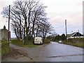
1
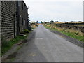
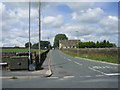
Ryecroft Lane at Ryecroft
Looking south-westward.
Image: © Peter Wood
Taken: 6 Aug 2018
0.10 miles
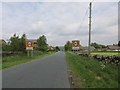
2
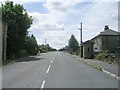
Scholes Moor Road - viewed from Chapelgate
Image: © Betty Longbottom
Taken: 24 Jul 2010
0.14 miles
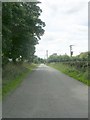
3
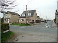
Cross Lane, Scholes
The other end of this lane has a signpost with a rare 'C' road number. At this end, however, the signpost simply shows 'Holmfirth'.
Image: © Humphrey Bolton
Taken: 14 Apr 2009
0.15 miles
4
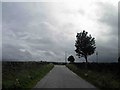
Junction of Ryecroft Lane to Cross lane
Image: © Steve Fareham
Taken: 16 Jun 2012
0.16 miles
5
Sandy Gate - viewed from Chapelgate
Image: © Betty Longbottom
Taken: 24 Jul 2010
0.20 miles
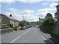
6
Scholes village
On Scholes Moor Road.
Image: © steven ruffles
Taken: 15 Jun 2015
0.20 miles
8
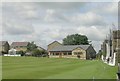
Scholes Cricket Club Clubhouse - Chapelgate
Image: © Betty Longbottom
Taken: 24 Jul 2010
0.21 miles
9
Chapelgate - viewed from Sandy Gate
Image: © Betty Longbottom
Taken: 24 Jul 2010
0.22 miles
10
Larch House
The entrance to Larch House, on the left, off the lane from Scholes to New Gate.
Image: © Roger May
Taken: 2 Jan 2006
0.22 miles