IMAGES TAKEN NEAR TO
Newgate Fold, HOLMFIRTH, HD9 1AJ
Introduction
This page details the photographs taken nearby to Newgate Fold, HD9 1AJ by members of the Geograph project.
The Geograph project started in 2005 with the aim of publishing, organising and preserving representative images for every square kilometre of Great Britain, Ireland and the Isle of Man.

There are currently over 7.5m images from over14,400 individuals and you can help contribute to the project by visiting https://www.geograph.org.uk
Image Map
Images are licensed for reuse under creativecommons.org/licenses/by-sa/2.0
Notes
- Clicking on the map will re-center to the selected point.
- The higher the marker number, the further away the image location is from the centre of the postcode.
Image Listing (155 Images Found)
Images are licensed for reuse under creativecommons.org/licenses/by-sa/2.0
Image
Details
Distance
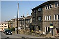
1
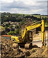
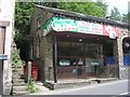
Holmfirth
Building site on South Lane in Holmfirth.
Image: © Peter McDermott
Taken: 27 Jun 2015
0.03 miles
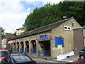
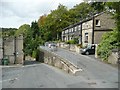
2
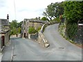
Junction of South Lane (left) and New Laithe Lane, Holmfirth
Image: © Humphrey Bolton
Taken: 11 Sep 2011
0.07 miles
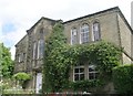
4
Housing in Gully
A mixture of old, new and renovated property in this suburb of Holmfirth
Image: © Graham Hogg
Taken: 28 Mar 2012
0.09 miles
5
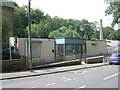
Phoenix Youth Centre - Dunford Road
Image: © Betty Longbottom
Taken: 24 Jul 2010
0.10 miles
8
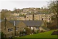
Hillside Houses on Dunford Road, Holmfirth
Houses up to 4 storeys make the most of the hillside location
Image: © Richard Kay
Taken: 7 Jan 2015
0.13 miles
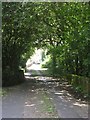
9
Junction of South Lane (left) and Back Lane, Holmfirth
Image: © Humphrey Bolton
Taken: 11 Sep 2011
0.14 miles