IMAGES TAKEN NEAR TO
Ings Mill Drive, HUDDERSFIELD, HD8 9PW
Introduction
This page details the photographs taken nearby to Ings Mill Drive, HD8 9PW by members of the Geograph project.
The Geograph project started in 2005 with the aim of publishing, organising and preserving representative images for every square kilometre of Great Britain, Ireland and the Isle of Man.

There are currently over 7.5m images from over14,400 individuals and you can help contribute to the project by visiting https://www.geograph.org.uk
Image Map
Images are licensed for reuse under creativecommons.org/licenses/by-sa/2.0
Notes
- Clicking on the map will re-center to the selected point.
- The higher the marker number, the further away the image location is from the centre of the postcode.
Image Listing (106 Images Found)
Images are licensed for reuse under creativecommons.org/licenses/by-sa/2.0
Image
Details
Distance
1
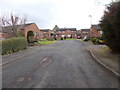
Ings Mill Drive - Ings Mill Avenue
Image: © Betty Longbottom
Taken: 18 Feb 2017
0.04 miles
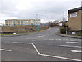
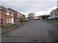
2
Ings Mill Avenue - viewed from Ings Mill Drive
Image: © Betty Longbottom
Taken: 18 Feb 2017
0.05 miles
3
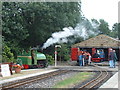
Clayton West, Kirklees Light Railway
Image: © Gordon Kneale Brooke
Taken: 26 Aug 2002
0.06 miles
4
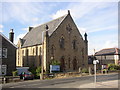
United Reformed Church, Church Lane, Clayton West
Image: © Humphrey Bolton
Taken: 7 Sep 2003
0.08 miles
6
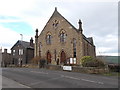
United Reformed Church - Church Lane
Image: © Betty Longbottom
Taken: 18 Feb 2017
0.09 miles
8
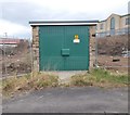
Electricity Substation No 3135 - Park Mill Way
Image: © Betty Longbottom
Taken: 18 Feb 2017
0.09 miles
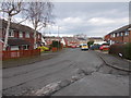
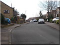
9
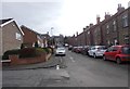
Albert Road - viewed from Ings Mill Drive
Image: © Betty Longbottom
Taken: 18 Feb 2017
0.09 miles