IMAGES TAKEN NEAR TO
Barnsley Road, HUDDERSFIELD, HD8 9HW
Introduction
This page details the photographs taken nearby to Barnsley Road, HD8 9HW by members of the Geograph project.
The Geograph project started in 2005 with the aim of publishing, organising and preserving representative images for every square kilometre of Great Britain, Ireland and the Isle of Man.

There are currently over 7.5m images from over14,400 individuals and you can help contribute to the project by visiting https://www.geograph.org.uk
Image Map
Images are licensed for reuse under creativecommons.org/licenses/by-sa/2.0
Notes
- Clicking on the map will re-center to the selected point.
- The higher the marker number, the further away the image location is from the centre of the postcode.
Image Listing (36 Images Found)
Images are licensed for reuse under creativecommons.org/licenses/by-sa/2.0
Image
Details
Distance
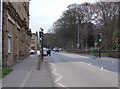
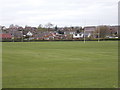
3
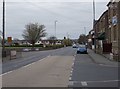
Wakefield Road - viewed from Barnsley Road
Image: © Betty Longbottom
Taken: 7 Apr 2017
0.03 miles
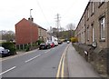
6
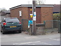
Electricity Substation No 2521 - Wakefield Road
Image: © Betty Longbottom
Taken: 7 Apr 2017
0.05 miles
7
Wakefield Road - viewed from Barnsley Road
Image: © Betty Longbottom
Taken: 7 Apr 2017
0.05 miles
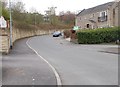
8
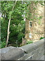
Marshall Mill House - Barnsley Road
Image: © Betty Longbottom
Taken: 7 Apr 2017
0.06 miles
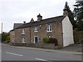
10
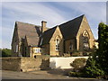
Former Scissett C of E School. Barnsley Road
The entrance is off Lower Common Lane. The building is now Hillside House Day Nursery.
Image: © Humphrey Bolton
Taken: 7 Sep 2003
0.07 miles