IMAGES TAKEN NEAR TO
Penistone Road, HUDDERSFIELD, HD8 8HY
Introduction
This page details the photographs taken nearby to Penistone Road, HD8 8HY by members of the Geograph project.
The Geograph project started in 2005 with the aim of publishing, organising and preserving representative images for every square kilometre of Great Britain, Ireland and the Isle of Man.

There are currently over 7.5m images from over14,400 individuals and you can help contribute to the project by visiting https://www.geograph.org.uk
Image Map
Images are licensed for reuse under creativecommons.org/licenses/by-sa/2.0
Notes
- Clicking on the map will re-center to the selected point.
- The higher the marker number, the further away the image location is from the centre of the postcode.
Image Listing (37 Images Found)
Images are licensed for reuse under creativecommons.org/licenses/by-sa/2.0
Image
Details
Distance

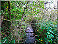
5
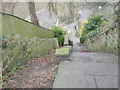
Stretch Gate climbing up to Penistone Road, Shelley
This comes out opposite Far Bank. There is an easier route to the right.
Image: © Humphrey Bolton
Taken: 4 Nov 2021
0.05 miles
6
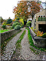
Shepley Dike looking downstream from Stretch Gate
There looks to be a pipe crossing the stream bed. The stream is the boundary between Shelley, on the left, and Shepley. The area to the right is the sitebof Shepley New Mills and is being developed for housing after being derelict for many years.
Image: © Humphrey Bolton
Taken: 4 Nov 2021
0.06 miles
7
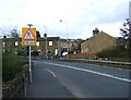
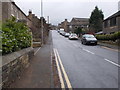
A629, Shelley
Heading north east towards Huddersfield.
Image: © JThomas
Taken: 3 Oct 2014
0.06 miles
8
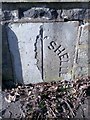
Old Boundary Marker by the A629, Penistone Road/Abbey Road
Parish Boundary Marker by the A629, in parish of Kirkburton (Kirklees District), Shelley Bank Bridge, West side of A629 bridge over Shelley/Shepley Dike. Shelley is North of the dike, and Shepley is south of the dike.
Inscription reads:- : (SHEPLEY) | SHELLEY :
Surveyed
Milestone Society National ID: YW_SHESHP01pb.
Image: © Milestone Society
Taken: Unknown
0.06 miles
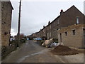
10
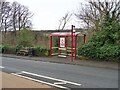
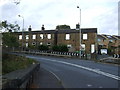
Bus stop and shelter on Penistone Road
Provided by West Yorkshire PTE
Image: © Graham Hogg
Taken: 10 Jan 2022
0.07 miles