IMAGES TAKEN NEAR TO
Cinderhill, HUDDERSFIELD, HD8 0UD
Introduction
This page details the photographs taken nearby to Cinderhill, HD8 0UD by members of the Geograph project.
The Geograph project started in 2005 with the aim of publishing, organising and preserving representative images for every square kilometre of Great Britain, Ireland and the Isle of Man.

There are currently over 7.5m images from over14,400 individuals and you can help contribute to the project by visiting https://www.geograph.org.uk
Image Map
Images are licensed for reuse under creativecommons.org/licenses/by-sa/2.0
Notes
- Clicking on the map will re-center to the selected point.
- The higher the marker number, the further away the image location is from the centre of the postcode.
Image Listing (32 Images Found)
Images are licensed for reuse under creativecommons.org/licenses/by-sa/2.0
Image
Details
Distance
1
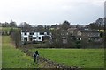
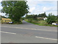
Cinder Hill
Old and new houses make up this hamlet. A footpath between Thorncliffe and Cinder Hill runs along the left side of the stone wall, where repairs are under way.
Image: © Richard Kay
Taken: 22 Feb 2008
0.02 miles
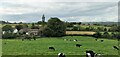
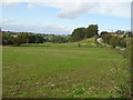
3
Grazing, Cinder Hill
Off Thorncliff Green Road.
Image: © JThomas
Taken: 12 Oct 2019
0.06 miles
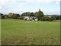
4
Burton Royd Lane at Cinder Hill
Looking north-westward across Jagger Lane and Laneside
Image: © Peter Wood
Taken: 30 Aug 2017
0.07 miles
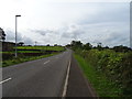
7
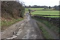
Thorncliffe Lane
The surface of the lane has been metalled but is falling into disrepair. Compare this lane with the footpath running parallel and 100m to the east.
Image: © Richard Kay
Taken: 22 Feb 2008
0.09 miles
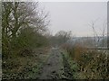
8
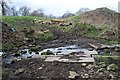
Footpath Ford at Thorncliffe
The footpath goes from Thorncliffe to Burton Royd Lane, but is not well-used. The farmer appears to have started construction of a multi-pipe culvert but has not completed the work.
The stream is not shown on the 1:50,000 OS Maps but is clearly shown on the 1:25,000 Series.
Image: © Richard Kay
Taken: 22 Feb 2008
0.09 miles
9
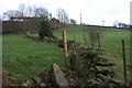
Footpath alongside ruined wall, Thorncliffe
The view is facing east, towards the hamlet of Thorncliffe. the public right of way footpath follows the left side of the broken-down wall, which has been replaced with a barbed-wire fence. The path is obstructed by a horizontal board. Emley Moor Transmitter Mast is visible on the skyline.
Image: © Richard Kay
Taken: 22 Feb 2008
0.09 miles