IMAGES TAKEN NEAR TO
Hallas Road, HUDDERSFIELD, HD8 0QQ
Introduction
This page details the photographs taken nearby to Hallas Road, HD8 0QQ by members of the Geograph project.
The Geograph project started in 2005 with the aim of publishing, organising and preserving representative images for every square kilometre of Great Britain, Ireland and the Isle of Man.

There are currently over 7.5m images from over14,400 individuals and you can help contribute to the project by visiting https://www.geograph.org.uk
Image Map
Images are licensed for reuse under creativecommons.org/licenses/by-sa/2.0
Notes
- Clicking on the map will re-center to the selected point.
- The higher the marker number, the further away the image location is from the centre of the postcode.
Image Listing (71 Images Found)
Images are licensed for reuse under creativecommons.org/licenses/by-sa/2.0
Image
Details
Distance
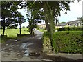
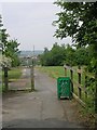
4
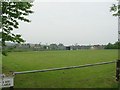
Gregory Playing Fields - Hallas Road
Image: © Betty Longbottom
Taken: 5 Jun 2010
0.06 miles
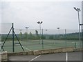
6
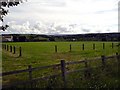
Playing Fields At Kirkburton
View south west towards Holmfirth and Brockholes from Burton Acres Lane.
Image: © Tim Marchant
Taken: 6 Jul 2008
0.08 miles
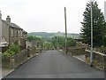
7
Track linking two parts of Burton Acres Lane
Image: © Betty Longbottom
Taken: 5 Jun 2010
0.09 miles