IMAGES TAKEN NEAR TO
Church Lane, HUDDERSFIELD, HD7 5TA
Introduction
This page details the photographs taken nearby to Church Lane, HD7 5TA by members of the Geograph project.
The Geograph project started in 2005 with the aim of publishing, organising and preserving representative images for every square kilometre of Great Britain, Ireland and the Isle of Man.

There are currently over 7.5m images from over14,400 individuals and you can help contribute to the project by visiting https://www.geograph.org.uk
Image Map
Images are licensed for reuse under creativecommons.org/licenses/by-sa/2.0
Notes
- Clicking on the map will re-center to the selected point.
- The higher the marker number, the further away the image location is from the centre of the postcode.
Image Listing (18 Images Found)
Images are licensed for reuse under creativecommons.org/licenses/by-sa/2.0
Image
Details
Distance
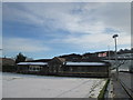
1
Footpath from Heath Road to Church Lane, Linthwaite
Image: © Chris Wimbush
Taken: 13 Aug 2011
0.04 miles
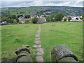
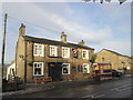
2
Linthwaite, near Huddersfield.
Looking down on Linthwaite. The old mill and narrow canal can be seen.The row of houses are on Manchester Road.
Image: © Nevin Arrow
Taken: 26 Jul 2003
0.06 miles
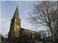
3
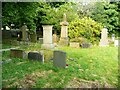
Gravestones in Christ Church Cenetery, Linthwaite
Image: © Humphrey Bolton
Taken: 10 Aug 2024
0.11 miles
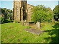
5
Gravestones, Christ Church, Linthwaite
Image: © Humphrey Bolton
Taken: 10 Aug 2024
0.11 miles
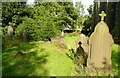
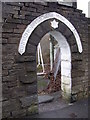
6
In the churchyard, Christ Church, Linthwaite
Image: © Humphrey Bolton
Taken: 10 Aug 2024
0.12 miles
7
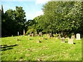
View in Christ Church Cemetery, Linthwaite
Image: © Humphrey Bolton
Taken: 10 Aug 2024
0.12 miles
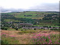
9
Entrance to Broad Oak cricket ground, Cowlersley Lane, Linthwaite
“Broad Oak Cricket & Athletic Grounds, 1882”
Image: © Humphrey Bolton
Taken: 6 Dec 2007
0.15 miles