1
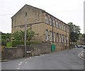
House for sale, Upper Clough
Image: © JThomas
Taken: 8 Nov 2018
0.03 miles
2
Victorian postbox and telephone box, Upper Clough
Postbox No. HD7 75.
See
Image] for postbox.
Image: © JThomas
Taken: 8 Nov 2018
0.04 miles
3
Victorian postbox, Upper Clough
Postbox No. HD7 75.
See
Image] for wider view.
Image: © JThomas
Taken: 8 Nov 2018
0.04 miles
4
Upper Clough
Beyond the hamlet of Upper Clough in the middle of the picture is Crimble Viaduct and on the skyline above a faint indication of the radio masts on Moorside Edge.
Image: © Peter Turner
Taken: 23 Jan 2003
0.06 miles
5
Buildings at Upper Clough, Linthwaite
The building on the left has small semi-circular windows, and might have been a barn.
Image: © Humphrey Bolton
Taken: 12 Jul 2007
0.07 miles
6
Road junction at Upper Clough, Linthwaite
Here there is a little triangular island on a steep slope, with telephone box (with its own telephone pole), postbox (Victorian), bus stop, street light and water trough. High House Lane goes steeply up to the right, and Upper Clough Road to the left.
Image: © Humphrey Bolton
Taken: 12 Jul 2007
0.07 miles
7
Upper Clough Road, Linthwaite
This road is part of the route from the A62 to Blackmoorfoot, which climbs over 100m in 1300m, but is nowhere excessively steep.
Image: © Humphrey Bolton
Taken: 12 Jul 2007
0.07 miles
8
Upper Clough
Looking south east - up the hill.
Image: © JThomas
Taken: 8 Nov 2018
0.08 miles
9
Methodist Sunday School, north end, Linthwaite
At the bottom of Stones Lane. There is a burial ground on the left.
Image: © Humphrey Bolton
Taken: 12 Jul 2007
0.10 miles
10
Methodist Assembly Hall, Linthwaite
Now used as the church.
Image: © Humphrey Bolton
Taken: 12 Jul 2007
0.10 miles


